
The Dictionary of Polish Place Names (Nazwy Miejscowe Polski) explains the origin of place names in Poland and details how the place name changed over time.
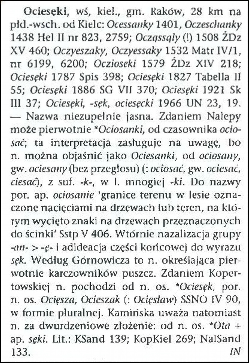
The present-day village of Ociesęki is located in Świętokrzyskie (Holy Cross) Voivodeship, about 28 kilometers southeast of Kielce. According to Polish Place Names, the village was referred to as Ocessanky in 1401, Oczeschanky in 1438, Ocząssąly (!) in 1508, Oczyeszaky and Oczyessaky in 1532, Oczioseki in 1579, Ociesęki in 1787, Ociesęki in 1827, Ociesęki in 1886, Ociesęki in 1921, and Ociesęki, -sęk, ociesęcki in 1966.
Nazwy Miejscowe Polski states that origin of the name of the village is not clear. The name might originally have been Ociosanki from the verb ociosać, meaning “to hew”. The term “ociosanie’ means the boundaries of an area in the forest marked with notches on trees, or an area where marks have been cut on trees intended for felling. Other hypotheses include that the name originally referred to forest clearers, that the name came from the personal name Ociesęk, or that the name came from the personal name Ota + “sęki” (meaning knots).
Source: Rymut, Kazimierz, and Barbara Czopek-Kopciuch, eds., Nazwy Miejscowe Polski (Place Names of Poland) – Krakow 2009, Volume VIII, page 34.
Click the link for a PDF copy of the Nazwy Miejscowe Polski entry for Ociesęki. Translated from the Polish, the entry reads:
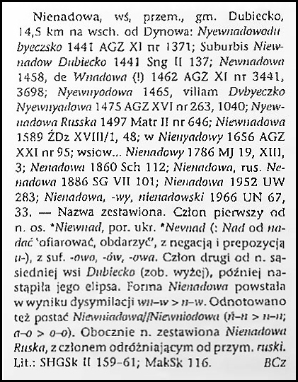
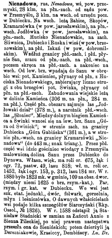
Ociesęki, a village in the Kielce powiat, Raków gmina, 28 km southeast of Kielce: Ocessanky 1401, Oczeschanky 1438 Hel II no. 823, 2759; Ocząssąly (!) 1508 ŹDz XV 460; Oczyeszaky, Oczyessaky 1532 Matr IV/1, no. 6199, 6200; Oczioseki 1579 ŹDz XIV 218; Ociesęki 1787 Spis 398; Ociesęki 1827 Tabella II 55; Ociesęki 1886 SG VII 370; Ociesęki 1921 Sk III 37; Ociesęki, –sęk, ociesęcki 1966 UN 23, 19. — The name is not entirely clear. According to Nalepa, it may originally have been *Ociosanki, from the verb ociosać (to hew); this interpretation deserves attention, as the name can be explained as Ociesanki, from ociosany (hewn), dialectal ociesany (without change of vowel) (: ociosać, dialectal ociesać, ciesać), with the suffix –k-, in the plural –ki. Compare the term ociosanie, meaning boundaries of an area in the forest marked with notches on trees, or an area where marks have been cut on trees intended for felling (Sstp V 406). Secondary nasalization of the group -an- > –ę– and association of the ending with the word sęk [knot]. According to Górnowicz, this name originally referred to forest clearers. According to Kopertowska, the name comes from the personal name *Ociesęk, compare personal names Ocięsza, Ocieszak (: Ocięsław) SSNO IV 90, in the plural form. Kamińska, however, considers the name to be a two-part compound: from the personal name *Ota + the appellative sęki [knots]. Lit.: KSand 139; KopKiel 269; NalSand 133. Iwana Nobis
Copyright © 2025 by Stephen J. Danko

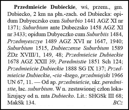


