
The cadastral map of the Polish village of Śliwnica (Dubiecko parish), created by officials of the Austrian Empire in 1852 is available on the website of the Polish State Archives at Szukaj w Archiwach. The files at Szukaj w Archiwach include four images that, together, form the complete map.
The Gesher Galicia Map Room includes a high-resolution version of the cadastral map of Śliwnica (Dubiecko parish) with the individual images stitched together. One of the great features of the maps in the Gesher Galicia Map Room is that the user can zoom in and out of the maps to view either an overview of the map or concentrate on the smallest details.
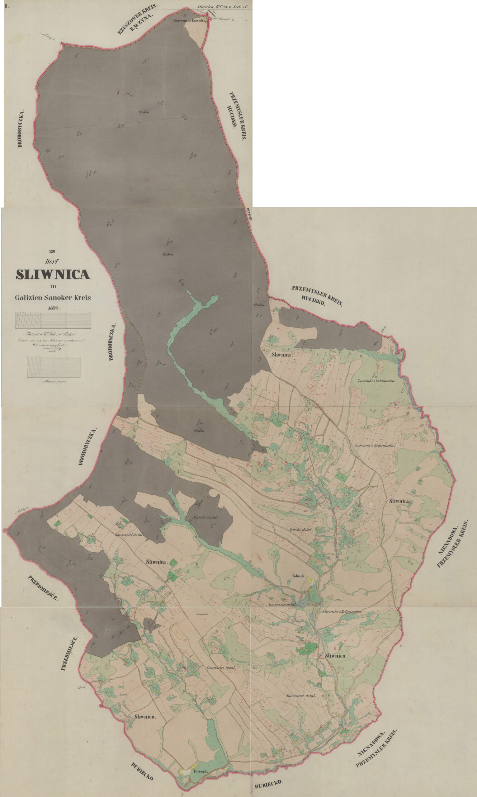
Śliwnica (Dubiecko parish) Cadastral Map – 1852
Dorf Sliwnica in Galizien Sanoker Kreis 1852 (State Archives in Poland);
digital images, Szukaj w Archiwach
(https://www.szukajwarchiwach.gov.pl/en/jednostka/-/jednostka/18050215:
accessed 27 November 2025)
Copyright © 2025 by Stephen J. Danko


