
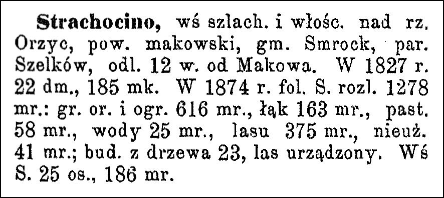
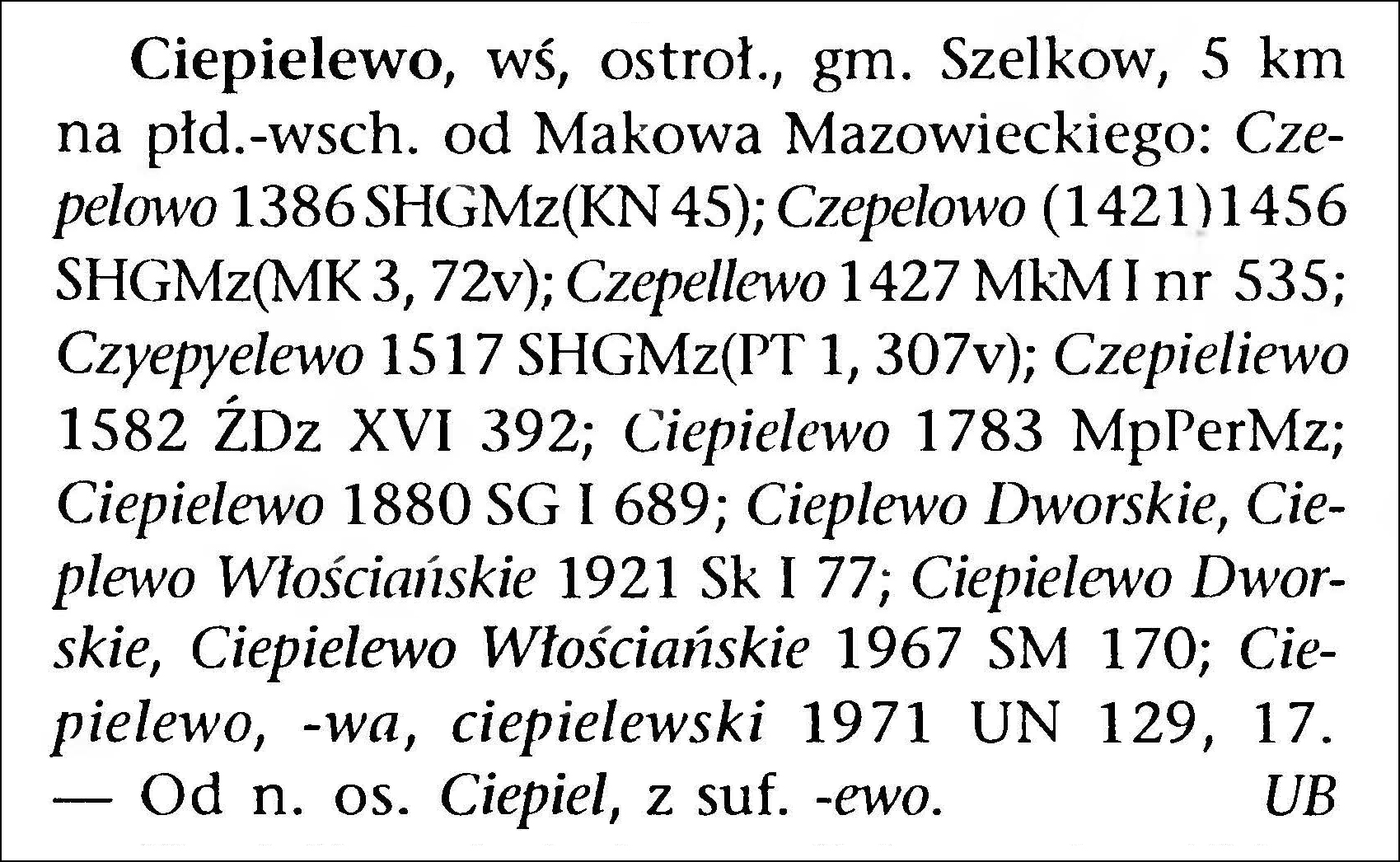
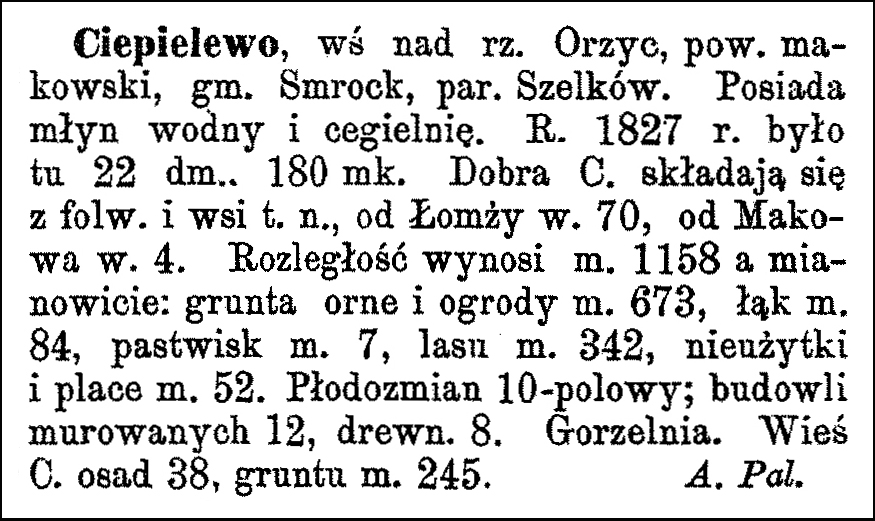
The Słownik Geograficzny Królestwa Polskiego i Innych Krajów Słowiańskich (Geographical Dictionary of the Kingdom of Poland and other Slavonic Countries) includes many entries for Polish villages called Las. The one numbered 13 belongs to the parish of Szelków.
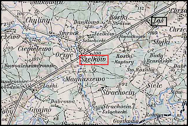
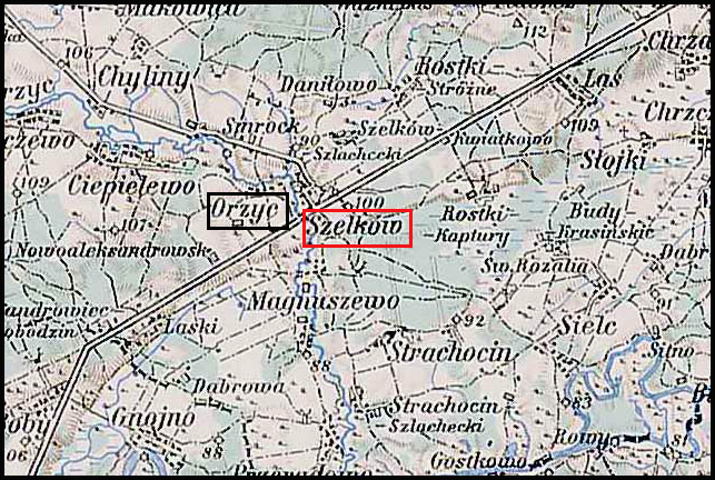
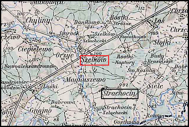
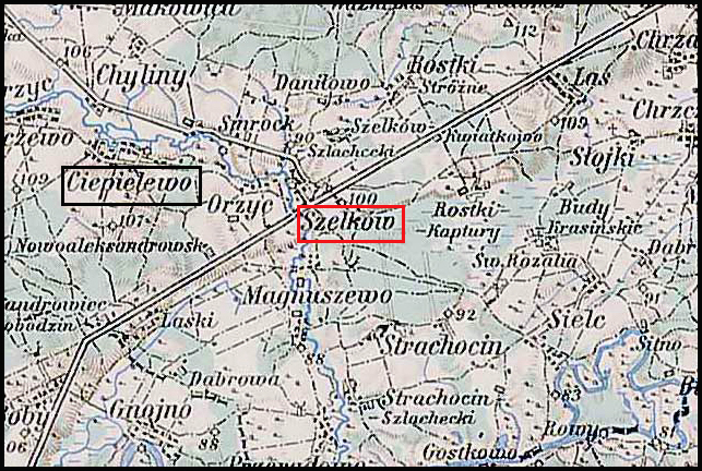
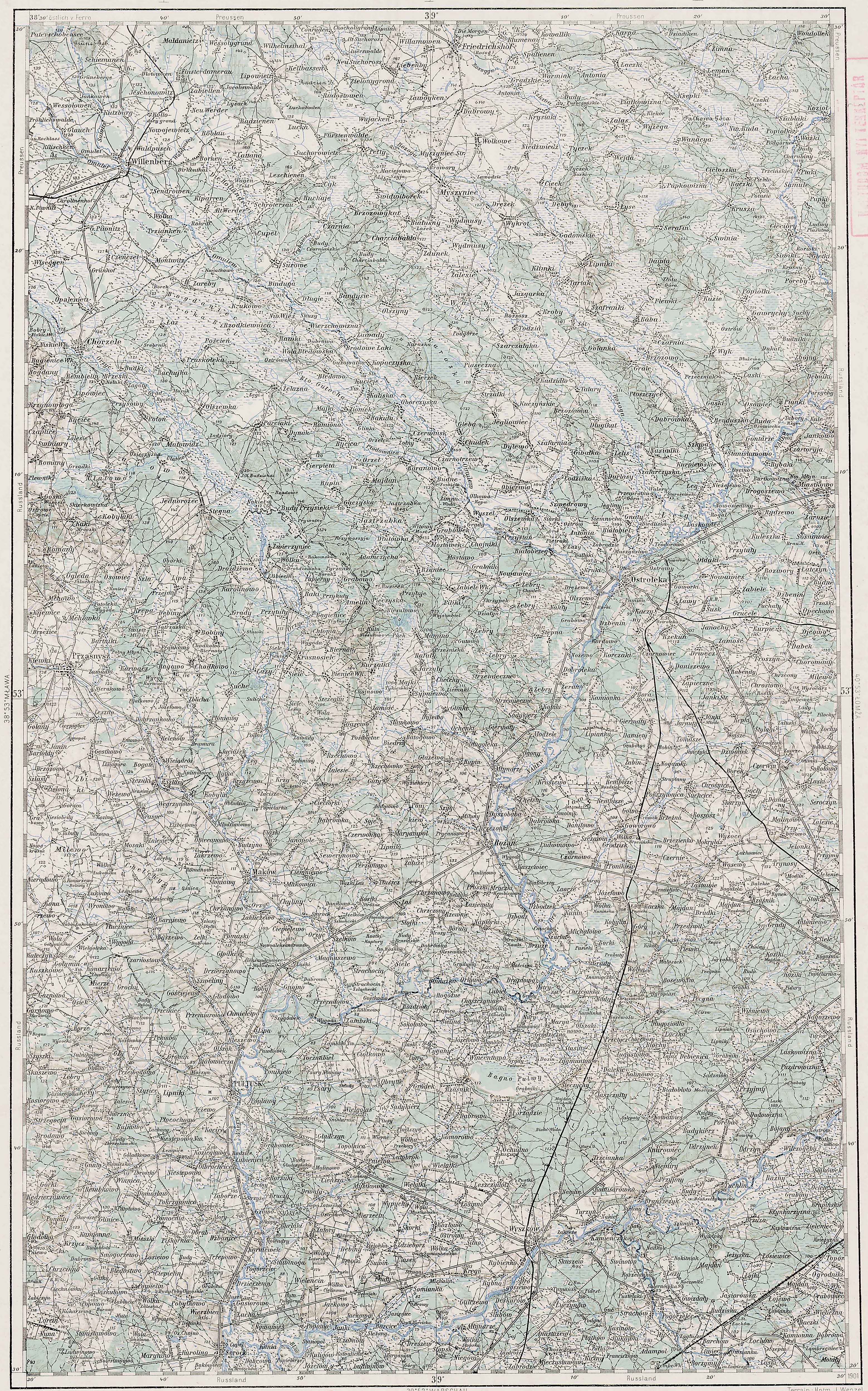
Las and Surrounding Area – 1910
Third Military Mapping Survey of Austria-Hungary (ELTE Faculty of Informatics,
Institute of Cartography and Geoinformatics); digital images, Lazarus ELTE
(http://lazarus.elte.hu/hun/digkonyv/topo/200e/39-53.jpg: accessed 20 December 2025)
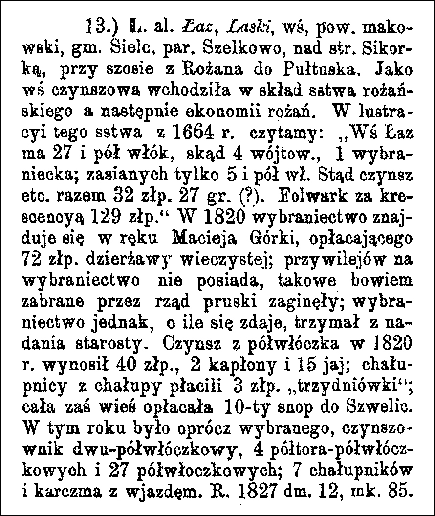
Source: Sulmierski, Filip, Bronisław Chlebowski, and Władysław Walewski, eds., Słownik Geograficzny Królestwa Polskiego i Innych Krajów Słowiańskich (Geographical Dictionary of the Kingdom of Poland and other Slavonic Countries) – Warsaw 1884, Volume V, page 81.
Click on the link for a PDF copy of the the Słownik Geograficzny entry for Las. Translated from the Polish, the entry reads:
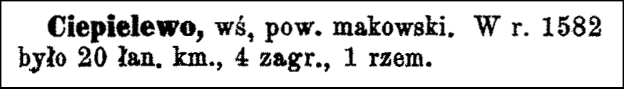
13.) Las al. Łaz, Laski, a village in Maków powiat, Sielc gmina, Szelkowo [Szelków] parish, situated on the Sikorka stream, along the road from Rożan to Pułtusk. As a rent-paying village, it was part of the Rożan starostwo and later the Rożan estate. In the 1664 survey of this starostwo, we read: “The village of Łaz has 27 and a half włóki [1 włóka = 30 mórgs; Gerald Ortell’s book on Polish Parish Records states that in the Russian partition 1 mórg = 1.388 acres], of which 4 belong to the village headman, and 1 to a privileged tenant; only 5 and a half włóki are sown. From this, the rent, etc., totals 32 zlotys 27 groszy (?). The manor farm, after improvements, yields 129 zlotys.” In 1820, the privileged tenancy was held by Maciej Górka, who paid 72 zlotys in perpetual lease; he did not possess the privileges for the tenancy, as these had been confiscated by the Prussian government and lost; however, the tenancy, it seems, was held by grant from the starost. The rent from a half-włóka in 1820 amounted to 40 zlotys, 2 capons and 15 eggs; cottagers paid 3 zlotys and “three days’ labor” per cottage; the entire village paid one-tenth sheaf to Szwelice. In that year, besides the privileged tenant, there was one tenant with two and a half włóki, 4 with one and a half włóki, and 27 with half a włóka; 7 cottagers and an inn with an entrance. In 1827, there were 12 houses and 85 inhabitants.
Copyright © 2026 by Stephen J. Danko


