
The cadastral map of the Polish village of Czystogarb (Czystohorb), created by officials of the Austrian Empire in 1852 is available on the website of the Polish State Archives at Szukaj w Archiwach. The files at Szukaj w Archiwach include twelve images that, together, form the complete map.
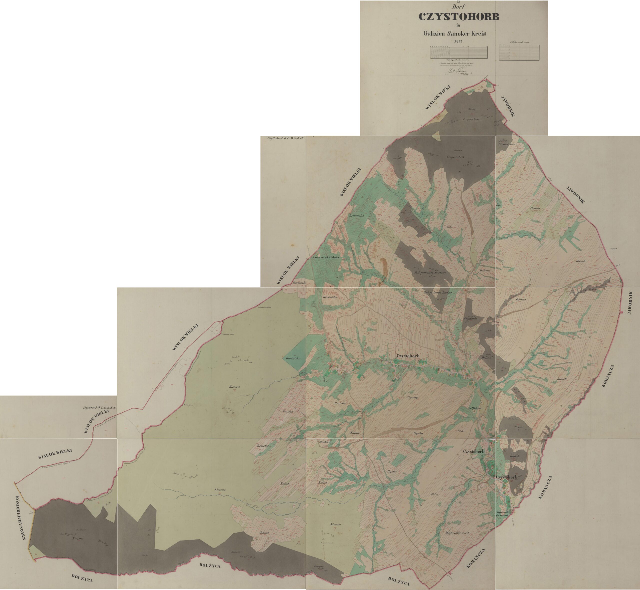
Czystogarb (Czystohorb) Cadastral Map – 1852
Dorf Czystohorb in Galizien Sanoker Kreis 1852 (State Archives in Poland); digital images, Szukaj w Archiwach
(https://www.szukajwarchiwach.gov.pl/en/jednostka/-/jednostka/18050151: accessed 19 December 2025)
Copyright © 2025 by Stephen J. Danko


