
The Słownik Geograficzny Królestwa Polskiego i Innych Krajów Słowiańskich (Geographical Dictionary of the Kingdom of Poland and other Slavonic Countries) includes an entry for the Polish village of Komańca.
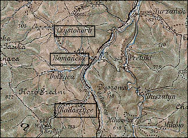
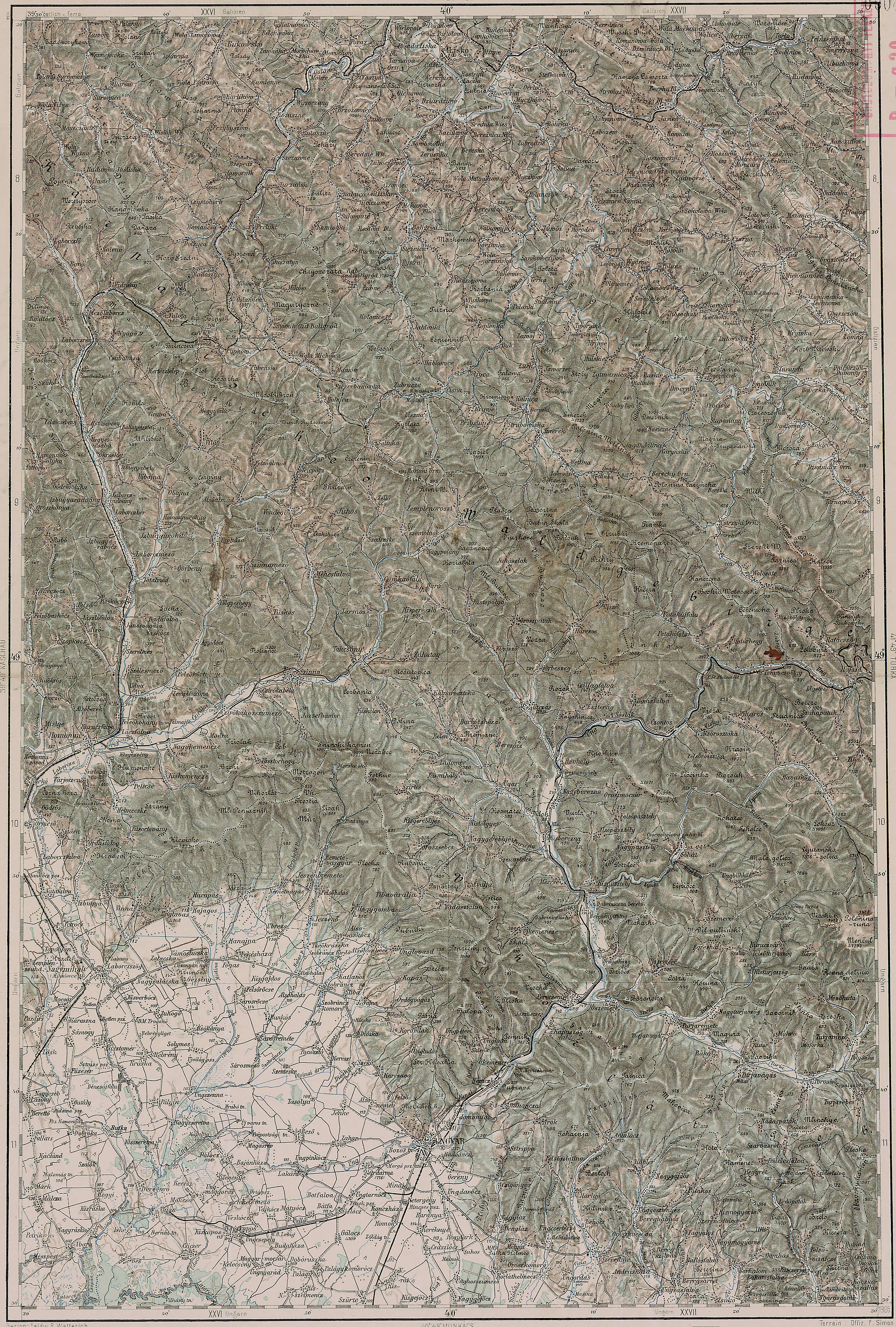
Komańcza and Surrounding Area – 1910
Third Military Mapping Survey of Austria-Hungary (ELTE Faculty of Informatics,
Institute of Cartography and Geoinformatics); digital images, Lazarus ELTE
(http://lazarus.elte.hu/hun/digkonyv/topo/200e/40-50.jpg: accessed 17 December 2025)
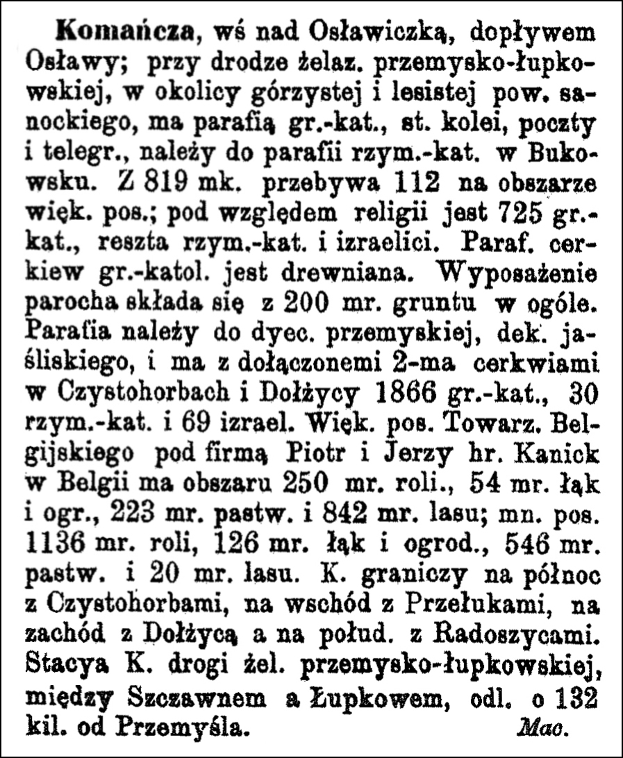
Source: Sulimierski, Filip, Bronisław Chlebowski, and Władysław Walewski, eds., Słownik Geograficzny Królestwa Polskiego i Innych Krajów Słowiańskich (Geographical Dictionary of the Kingdom of Poland and other Slavonic Countries) – Warsaw 1883, Volume IV, pages 296-297.
Click on the link for a PDF copy of the first Słownik Geograficzny entries for Komańcza. Translated from the Polish, the entry reads:
Komańcza, a village on the Osławiczka [now known as Osławica] River, a tributary of the Osława; located on the Przemyśl-Łupków railway line, in a mountainous and forested area of the Sanok district. It has a Greek Catholic parish, a railway station, post office, and telegraph office, and belongs to the Roman Catholic parish in Bukowsko. Of the 819 inhabitants, 112 reside on the larger estate; in terms of religion, there are 725 Greek Catholics, the rest are Roman Catholics and Jews. The Greek Catholic parish church is wooden. The parish priest’s endowment consists of 200 acres of land in total. The parish belongs to the Przemyśl diocese, Jaśliska deanery, and, together with the two churches in Czystohorb [now known as Czystogarb] and Dołżyca, has 1866 Greek Catholics, 30 Roman Catholics, and 69 Jews. The larger estate, owned by a Belgian Company under the name of Counts Piotr and Jerzy Kanicki in Belgium, has 250 mórgs [Gerald Ortell’s book on Polish Parish Records states that in Galicia 1 morg = 1.422 acres] of arable land, 54 mórgs of meadows and gardens, 223 mórgs of pastures, and 842 mórgs of forest; the smaller estate has 1136 mórgs of arable land, 126 mórgs of meadows and gardens, 546 mórgs of pastures, and 20 mórgs of forest. Komańcza borders Czystohorb to the north, Przełuki to the east, Dołżyca to the west, and Radoszyce to the south. The Komańcza railway station is on the Przemyśl-Łupków line, between Szczawne and Łupków, 132 km from Przemyśl.
M. Maciszewski
Copyright © 2025 by Stephen J. Danko


