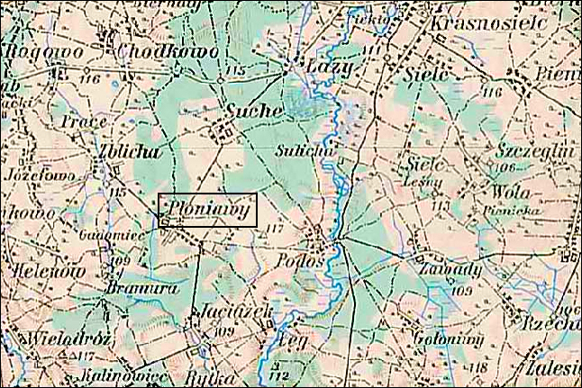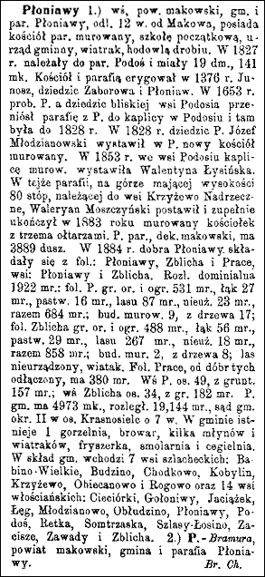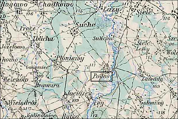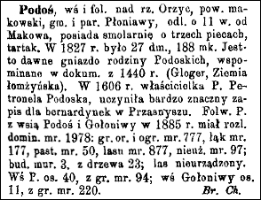
The village of Podoś is significant in my family history because Podoś was the parish for the village of Chodkowo, the location in Poland in which many of my Chodkowski ancestors lived. The church in Podoś is very small and, as a parish, has since been replaced by that in Płoniawy.
Source: Chlebowski, Bronisław, Władysław Walewski, and Filip Sulimierski, eds., Słownik Geograficzny Królestwa Polskiego i Innych Krajów Słowiańskich (Geographical Dictionary of the Kingdom of Poland and other Slavonic Countries) – Warsaw 1887, Volume VIII, page 463.
Click on the link for a PDF copy of the Słownik Geograficzny entry for Podoś. Translated from the Polish, the entry reads:
Podoś, a village and grange [large manorial farmstead] on the Orzyc River in the Maków Powiat, Płoniawy Gmina and Parish, about 11 versts [0.66 miles per verst] from Maków; located there is a pitch burner with three stoves and a sawmill. In the year 1827 there were 27 homes and 188 residents. It is the old “nest’ of the Podoski family, mentioned in documents from the year 1440 (Gloger, Łomża Ziemia). In the year 1606 the owner of Podoś was Petronela Podoska; she made a very significant endowment to the Bernardines in Przasnysz. In the year 1885 the Podoś grange, with the villages of Podoś and Gołoniwy, had a wide domain with 1978 morgs [in the Russian partition 1 morg = 1.388 acres]: 777 morgs of arable land and gardens, 177 morgs of meadows, 50 morgs of pastures, 877 morgs of forests, and 97 morgs of unused land; there were 3 stone buildings and 23 wooden buildings; the forest is unsettled. The village of Podoś has 40 residents with 94 morgs of land; the village of Gołoniwy has 11 residents and 220 morgs of land .         Bronisław Chlebowski
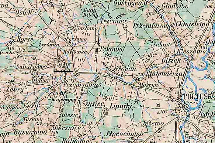
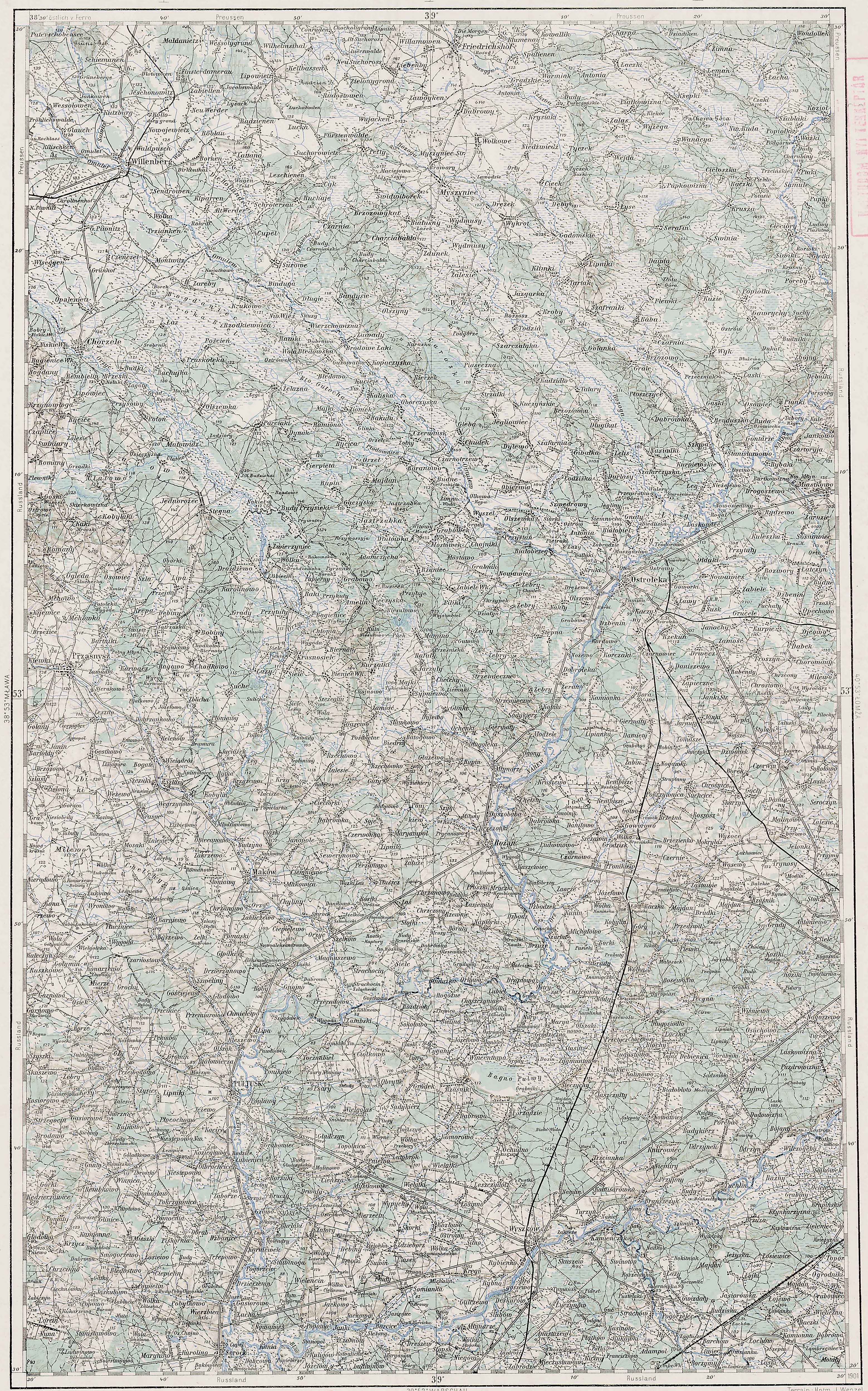
The maps of the Third Military Mapping Survey of Austria-Hungary and the entries in the Słownik Geograficzny were prepared at about the same time and make a good pair for studying places in and around the Congress Kingdom of Poland at the end of the 19th century and beginning of the 20th century, a time period when the Eastern European ancestors of present-day Americans left their homelands for the United States.
The village of Gzy is significant in my family history because Gzy was the parish for the village of Borze, the location in Poland in which many of my Burski ancestors lived.
Source: Sulimierski, Filip, Bronisław Chlebowski, and Władysław Walewski, eds., Słownik Geograficzny Królestwa Polskiego i Innych Krajów Słowiańskich (Geographical Dictionary of the Kingdom of Poland and other Slavonic Countries) – Warsaw 1881, Volume II, page 927.
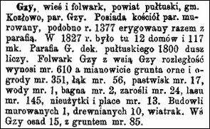
Click on the link for a PDF copy of the Słownik Geograficzny entry for Gzy. Translated from the Polish, the entry reads:
Gzy,a village and grange [a large manorial farmstead] in the Pułtusk Powiat, Kozłowo Gmina, and Gzy Parish. There is a wooden parish church here, reportedly erected in the year 1377 together with the parish. In the year 1827 there were 12 homes and 117 residents here. The parish of Gzy in the Pułtusk Deanery serves 1800 souls. The Gzy Grange and the village of Gzy contribute an area of 610 morgs [in the Russian partition 1 morg = 1.388 acres] including 351 morgs of arable land and gardens, 56 morgs of forests, 17 morgs of pastures, 145 morgs of water, and 13 morgs of unused land and town squares. There is 1 stone building, 10 wooden buildings, and a windmill. The settled village of Gzy occupies 15 morgs, and with its land it occupies 85 morgs.
The maps of the Third Military Mapping Survey of Austria-Hungary and the entries in the Słownik Geograficzny were prepared at about the same time and make a good pair for studying places in and around the Congress Kingdom of Poland at the end of the 19th century and beginning of the 20th century, a time period when the Eastern European ancestors of present-day Americans left their homelands for the United States.
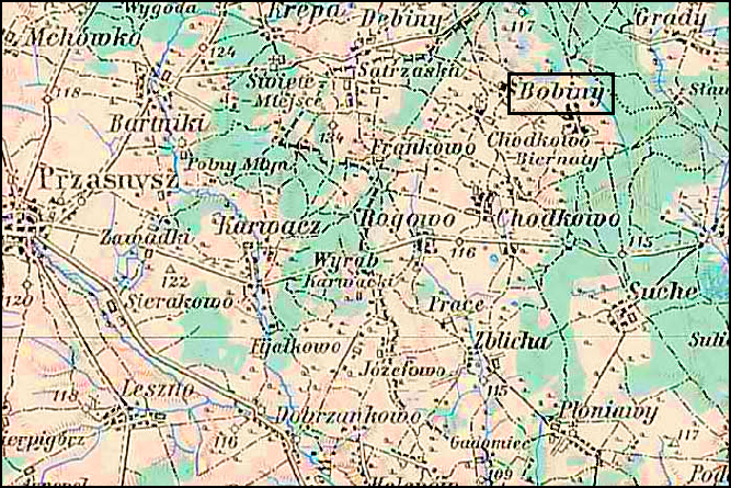
The village of Bobino is the location in Poland in which some of my Chodkowski ancestors lived. In particular, my 5ht cousin 3X removed Ignacy Chodkowski married Katarzyna Bartold from Bobino, and my 4th cousin 4X removed Ignacy Chodkowski resided in Bobino wielkie with his wife Salomea née Bobińska. Incidentally, Ignacy Chodkowski, husband of Salomea née Bobińska was the nephew of Ignacy Chodkowski, husband of Katarzyna Bartold.
Austrian Military Map of Bobino wielkie and Bobino grzybki Area – 1910
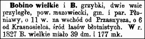
Słownik Geograficzny Entry for Bobino wielkie and Bobino grzybki
Source: Sulimierski, Filip, Bronisław Chlebowski, and Władysław Walewski, eds., Słownik Geograficzny Królestwa Polskiego i Innych Krajów Słowiańskich (Geographical Dictionary of the Kingdom of Poland and other Slavonic Countries) – Warsaw 1881, Volume II, page 256.
Click on the link for a PDF copy of the Słownik Geograficzny entry for Bobino wielkie and Bobino grzybki. Translated from the Polish, the entry reads:
Bobino wielkie and B[obino] grzybki, two adjacent villages in the Mazovian Powiat, Gmina and Parish of Płoniawy,about 11 versts [0.66 miles per verst] to the east of Przasnysz and about 6Â versts from Krasnosielc, in the middle of muddy forests. In the year 1827, Bobino wielkie had 39 homes and 177 residents.
The maps of the Third Military Mapping Survey of Austria-Hungary and the entries in the Słownik Geograficzny were prepared at about the same time and make a good pair for studying places in and around the Congress Kingdom of Poland at the end of the 19th century and beginning of the 20th century, a time period when the Eastern European ancestors of present-day Americans left their homelands for the United States.
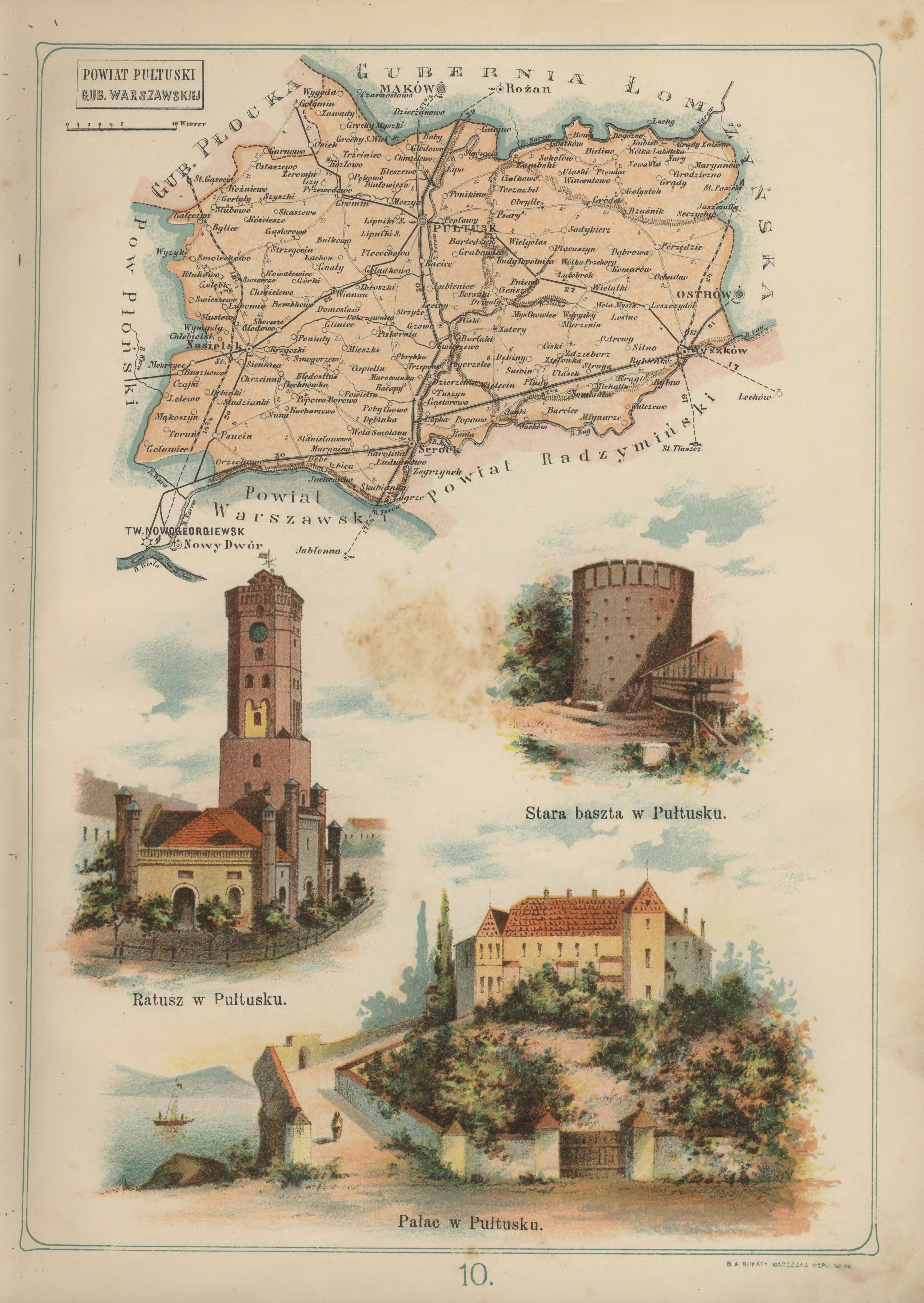
Pułtusk Powiat in the Warsaw Gubernia – 1907 Józef Michał Bazewicz, Atlas geograficzny ilustrowany Królestwa Polskiego (Litografia B. A. Bukaty, Warsaw, 1907); digital images, Mapywig (http://igrek.amzp.pl/details.php?id=11767061 : accessed 02 February 2019).
The administrative structure of the parishes of Dzierżenin, Gzy, Klukowo, Pokrzywnica, Przewodowo, Pułtusk, Smogorzewo Pańskie, Szyszki, Winnica, and Żeromin can be described as follows:
01 Jul 1569-03 Oct 1795:Village, Zakroczym Ziemia, Masovia Voivodeship, Crown of the Kingdom of Poland, Polish-Lithuanian Commonwealth
04 Oct 1795-08 Jul 1807:Village, Kammerdepartement Płock, Province of New East Prussia, Kingdom of Prussia
09 Jul 1807-08 Jun 1815:Village, Pułtusk Powiat, Płock Department, Duchy of Warsaw
09 Jun 1815-15 Jan 1816:Village, Pułtusk Powiat, Płock Department, Congress Kingdom of Poland
16 Jan 1816-06 Mar 1837:Village, Pułtusk Obwód, Płock Voivodeship, Congress Kingdom of Poland
07 Mar 1837-10 Nov 1842:Village, Pułtusk Obwód, Płock Gubernia, Congress Kingdom of Poland
11 Nov 1842-30 Dec 1866:Village, Pułtusk Powiat, Płock Gubernia, Congress Kingdom of Poland
31 Dec 1866-25 Dec 1893: Village, Pułtusk Powiat, Łomża Gubernia, Congress Kingdom of Poland
26 Dec 1893-07 Sep 1915:Village, Pułtusk Powiat, Warsaw Gubernia, Congress Kingdom of Poland
08 Sep 1915-10 Nov 1918:Village, Pułtusk Powiat, General Government of Warsaw, German Empire
11 Nov 1918-07 Oct 1939:Village, Pułtusk Powiat, Warsaw Voivodeship, Second Polish Republic
08 Oct 1939-27 Jun 1945:Village, Landkreis Ostenburg, Regierungsbezirk Zichenau, Province of East Prussia, German Reich
28 Jun 1945-21 Jul 1952:Village, Pułtusk Powiat, Warsaw Voivodeship, Republic of Poland
01 Jun 1975-30 Dec 1989:Village, Ciechanów Voivodeship, Polish People’s Republic
31 Dec 1989-30 Dec 1998:Village, Ciechanów Voivodeship, Third Polish Republic
31 Dec 1998-Present:Village, Pułtusk Powiat, Masovian Voivodeship, Third Polish Republic
The administrative structure of the parish of Nasielsk can be described as follows:
01 Jul 1569-03 Oct 1795:Village, Zakroczym Ziemia, Masovia Voivodeship, Crown of the Kingdom of Poland, Polish-Lithuanian Commonwealth
04 Oct 1795-08 Jul 1807:Village, Kammerdepartement Płock, Province of New East Prussia, Kingdom of Prussia
09 Jul 1807-08 Jun 1815:Village, Pułtusk Powiat, Płock Department, Duchy of Warsaw
09 Jun 1815-15 Jan 1816:Village, Pułtusk Powiat, Płock Department, Congress Kingdom of Poland
16 Jan 1816-06 Mar 1837:Village, Pułtusk Obwód, Płock Voivodeship, Congress Kingdom of Poland
07 Mar 1837-10 Nov 1842:Village, Pułtusk Obwód, Płock Gubernia, Congress Kingdom of Poland
11 Nov 1842-30 Dec 1866:Village, Pułtusk Powiat, Płock Gubernia, Congress Kingdom of Poland
31 Dec 1866-25 Dec 1893: Village, Pułtusk Powiat, Łomża Gubernia, Congress Kingdom of Poland
26 Dec 1893-07 Sep 1915:Village, Pułtusk Powiat, Warsaw Gubernia, Congress Kingdom of Poland 08 Sep 1915-10 Nov 1918:Village, Pułtusk Powiat, General Government of Warsaw, German Empire
11 Nov 1918-07 Oct 1939:Village, Pułtusk Powiat, Warsaw Voivodeship, Second Polish Republic
08 Oct 1939-27 Jun 1945:Village, Landkreis Ostenburg, Regierungsbezirk Zichenau, Province of East Prussia, German Reich
28 Jun 1945-21 Jul 1952:Village, Pułtusk Powiat, Warsaw Voivodeship, Republic of Poland
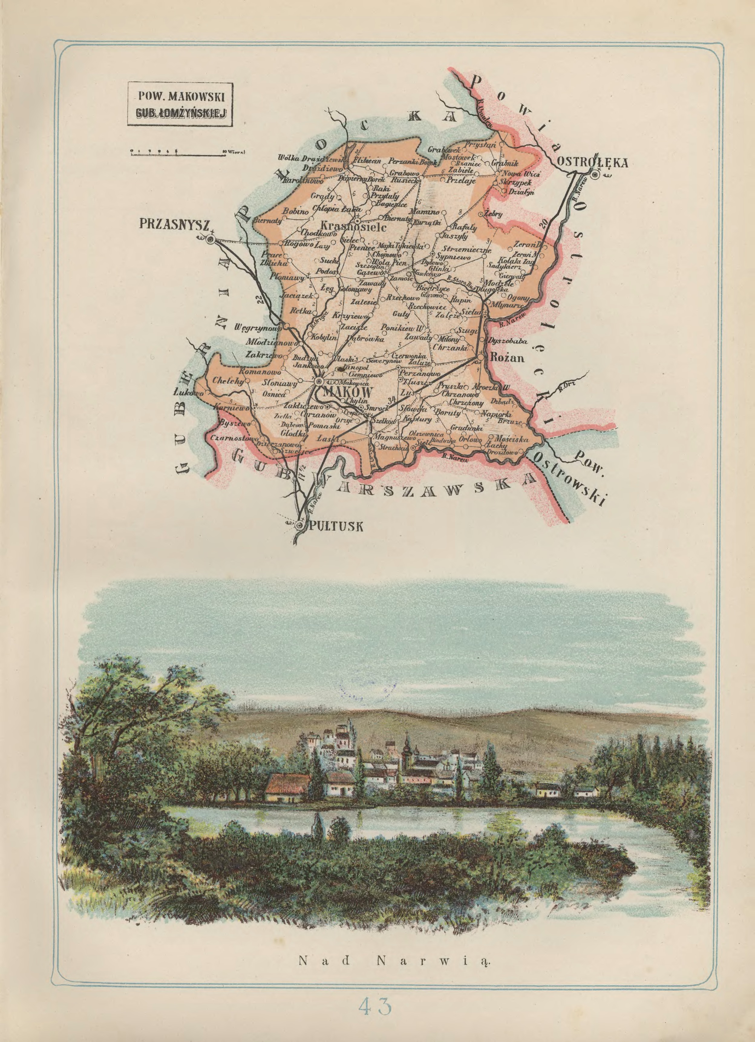
Maków Powiat in the Łomża Gubernia – 1907 Józef Michał Bazewicz, Atlas geograficzny ilustrowany Królestwa Polskiego (Litografia B. A. Bukaty, Warsaw, 1907); digital images, Mapywig (http://igrek.amzp.pl/details.php?id=11767094 : accessed 02 February 2019).
The administrative structure of the parishes of Karniewo, Maków Mazowiecki, and Szwelice can be described as follows:
01 Jul 1569-03 Oct 1795:Village, Różan Ziemia, Masovian Voivodeship, Province of Greater Poland, Polish-Lithuanian Commonwealth
04 Oct 1795-13 Oct 1809:Village, Kammerdepartement Płock, Province of New East Prussia, Kingdom of Prussia
14 Oct 1809-09 Jun 1815:Village, Pułtusk Powiat, Płock Department, Duchy of Warsaw
09 Jun 1815-15 Jan 1816:Village, Pułtusk Powiat, Płock Department, Congress Kingdom of Poland
16 Jan 1816-06 Mar 1837:Village, Pułtusk Obwód, Płock Voivodeship, Congress Kingdom of Poland
07 Mar 1837-10 Oct 1842:Village, Pułtusk Obwód, Płock Gubernia, Congress Kingdom of Poland
11 Oct 1842-30 Dec 1866:Village, Pułtusk Powiat, Płock Gubernia, Congress Kingdom of Poland
31 Dec 1866-17 Oct 1915:Village, Maków Powiat, Łomża Gubernia, Congress Kingdom of Poland
18 Oct 1915-10 Nov 1918:Village, General Government of Warsaw, German Empire
11 Nov 1918-31 Aug 1939:Village, Maków Mazowiecki Powiat, Warsaw Voivodeship, Second Polish Republic
01 Sep 1939-27 Jun 1945:Village, Warsaw Department, General Government, German Reich
28 Jun 1945-21 Jul 1952:Village, Maków Mazowiecki Powiat, Warsaw Voivodeship, Republic of Poland
01 Jun 1975-30 Dec 1989:Village, Ciechanów Voivodeship, Polish People’s Republic
31 Dec 1989-30 Dec 1998:Village, Ciechanów Voivodeship, Third Polish Republic
31 Dec 1998-Present:Village, Maków Powiat, Masovian Voivodeship, Third Polish Republic
The administrative structure of the parishes of Czerwonka, Gąsewo Poduchowne, Płoniawy, Podoś, Różan, Rzewnie (established 15 May 1958), Sieluń-Majorat, Sypniewo (established 22 Jul 1914) Szelków, and Węgrzynowo can be described as follows:
01 Jul 1569-03 Oct 1795:Village, Różan Ziemia, Masovian Voivodeship, Province of Greater Poland, Polish-Lithuanian Commonwealth
04 Oct 1795-13 Oct 1809:Village, Kammerdepartement Płock, Province of New East Prussia, Kingdom of Prussia
14 Oct 1809-09 Jun 1815:Village, Pułtusk Powiat, Płock Department, Duchy of Warsaw
09 Jun 1815-15 Jan 1816:Village, Pułtusk Powiat, Płock Department, Congress Kingdom of Poland
16 Jan 1816-06 Mar 1837:Village, Pułtusk Obwód, Płock Voivodeship, Congress Kingdom of Poland
07 Mar 1837-10 Oct 1842:Village, Pułtusk Obwód, Płock Gubernia, Congress Kingdom of Poland
11 Oct 1842-30 Dec 1866:Village, Pułtusk Powiat, Płock Gubernia, Congress Kingdom of Poland
31 Dec 1866-17 Oct 1915:Village, Maków Powiat, Łomża Gubernia, Congress Kingdom of Poland
18 Oct 1915-10 Nov 1918:Village, General Government of Warsaw, German Empire
11 Nov 1918-31 Aug 1939:Village, Maków Mazowiecki Powiat, Warsaw Voivodeship, Second Polish Republic
01 Sep 1939-27 Jun 1945:Village, Warsaw Department, General Government, German Reich
28 Jun 1945-21 Jul 1952:Village, Maków Mazowiecki Powiat, Warsaw Voivodeship, Republic of Poland
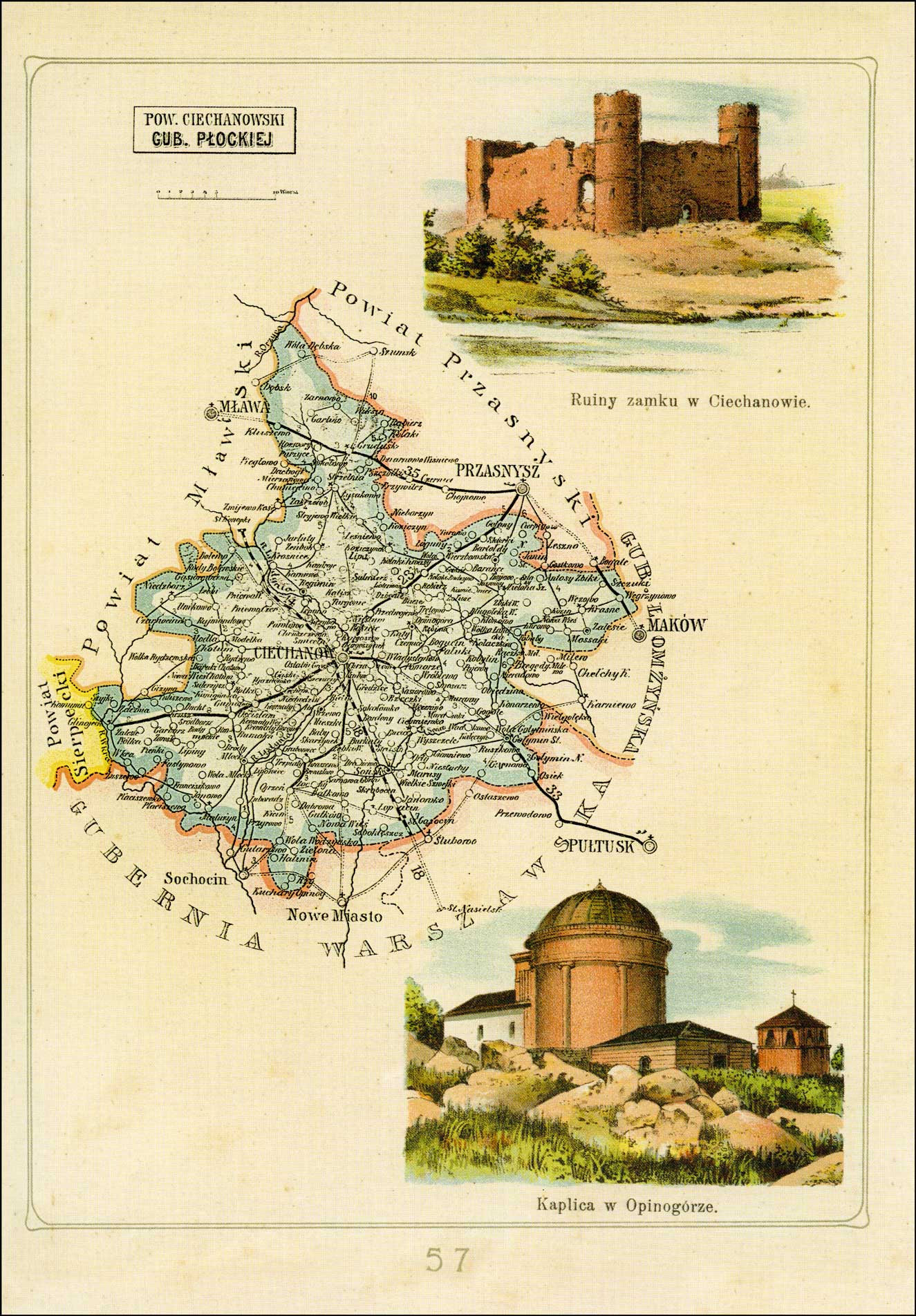
Ciechanów Powiat in the Płock Gubernia – 1907 Józef Michał Bazewicz, Atlas geograficzny ilustrowany Królestwa Polskiego (Litografia B. A. Bukaty, Warsaw, 1907); digital images, Mapywig (http://igrek.amzp.pl/details.php?id=11767108 : accessed 02 February 2019).
The administrative structure of the parishes of Ciechanów, Ciemniewko, Gołymin, Grudusk, Koziczynek, Kraszewo, Lekowo, Łopacin, Łysakowo, Młock-Kopacze, Opinogóra Górna, Pałuki, Sońsk, and Zeńbok can be described as follows:
01 Jul 1569-04 Oct 1795: Village, Ciechanów Ziemia, Masovian Voivodeship, Province of Greater Poland, Polish-Lithuanian Commonwealth
04 Oct 1795-08 Jul 1807: Village, Kammerdepartement Płock, Province of New East Prussia, Kingdom of Prussia
09 Jul 1807-08 Jun 1815: Village, Przasnysz Powiat, Płock Department, Duchy of Warsaw
09 Jun 1815-15 Jan 1816: Village, Przasnysz Powiat, Płock Department, Congress Kingdom of Poland
16 Jan 1816-06 Mar 1837: Village, Przasnysz Obwód, Płock Voivodeship, Congress Kingdom of Poland
07 Mar 1837-10 Nov 1842: Village, Przasnysz Obwód, Płock Gubernia, Congress Kingdom of Poland
10 Nov 1842-17 Oct 1915: Village, Przasnysz Powiat, Płock Gubernia, Congress Kingdom of Poland
18 Oct 1915-10 Nov 1918: Village, Mława Powiat, General Government of Warsaw, German Empire
11 Nov 1918-07 Oct 1939:Village, Ciechanów Powiat, Warsaw Voivodeship, Second Polish Republic
08 Oct 1939-27 Jun 1945:Village, Landkreis Zichenau, Regierungsbezirk Zichenau, Province of East Prussia, German Reich
28 Jun 1945-21 Jul 1952:Village, Ciechanów Powiat, Warsaw Voivodeship, Republic of Poland
22 Jul 1952-31 May 1975:Village, Warsaw Voivodeship, Polish People’s Republic
01 Jun 1975-30 Dec 1989:Village, Ciechanów Voivodeship, Polish People’s Republic
31 Dec 1989-30 Dec 1998:Village, Ciechanów Voivodeship, Third Polish Republic
31 Dec 1998-Present:Village, Ciechanów Powiat, Masovian Voivodeship, Third Polish Republic
The administrative structure of the parishes of Glinojeck, Malużyn, and Sulerzyż can be described as follows:
01 Jul 1569-04 Oct 1795: Village, Płock Voivodeship, Province of Greater Poland, Polish-Lithuanian Commonwealth
04 Oct 1795-08 Jul 1807: Village, Kammerdepartement Płock, Province of New East Prussia, Kingdom of Prussia
09 Jul 1807-08 Jun 1815:Village, Przasnysz Powiat, Płock Department, Duchy of Warsaw
09 Jun 1815-15 Jan 1816: Village, Przasnysz Powiat, Płock Department, Congress Kingdom of Poland
16 Jan 1816-06 Mar 1837:Village, Przasnysz Obwód, Płock Voivodeship, Congress Kingdom of Poland
07 Mar 1837-10 Nov 1842:Village, Przasnysz Obwód, Płock Gubernia, Congress Kingdom of Poland
11 Nov 1842-30 Dec 1866:Village, Przasnysz Powiat, Płock Gubernia, Congress Kingdom of Poland
31 Dec 1866-17 Oct 1915: Village, Przasnysz Powiat, Płock Gubernia, Congress Kingdom of Poland
18 Oct 1915-10 Nov 1918: Village, Mława Powiat, General Government of Warsaw, German Empire
11 Nov 1918-07 Oct 1939:Village, Ciechanów Powiat, Warsaw Voivodeship, Second Polish Republic
08 Oct 1939-27 Jun 1945:Village, Landkreis Zichenau, Regierungsbezirk Zichenau, Province of East Prussia, German Reich
28 Jun 1945-21 Jul 1952:Village, Ciechanów Powiat, Warsaw Voivodeship, Republic of Poland
22 Jul 1952-31 May 1975:Village, Warsaw Voivodeship, Polish People’s Republic
01 Jun 1975-30 Dec 1989: Village, Ciechanów Voivodeship, Polish People’s Republic
31 Dec 1989-30 Dec 1998: Village, Ciechanów Voivodeship, Third Polish Republic
31 Dec 1998-Present: Village, Ciechanów Powiat, Masovian Voivodeship, Third Polish Republic
The administrative structure of the parish of Niedzbórz can be described as follows:
01 Jul 1569-04 Oct 1795: Village, Zawkrze Ziemia, Płock Voivodeship, Province of Greater Poland, Polish-Lithuanian Commonwealth
04 Oct 1795-08 Jul 1807: Village, Kammerdepartement Płock, Province of New East Prussia, Kingdom of Prussia
09 Jul 1807-08 Jun 1815:Village, Przasnysz Powiat, Płock Department, Duchy of Warsaw
09 Jun 1815-15 Jan 1816: Village, Przasnysz Powiat, Płock Department, Congress Kingdom of Poland
16 Jan 1816-06 Mar 1837:Village, Przasnysz Obwód, Płock Voivodeship, Congress Kingdom of Poland
07 Mar 1837-10 Nov 1842:Village, Przasnysz Obwód, Płock Gubernia, Congress Kingdom of Poland
11 Nov 1842-30 Dec 1866:Village, Przasnysz Powiat, Płock Gubernia, Congress Kingdom of Poland
31 Dec 1866-17 Oct 1915: Village, Przasnysz Powiat, Płock Gubernia, Congress Kingdom of Poland
18 Oct 1915-10 Nov 1918: Village, Mława Powiat, General Government of Warsaw, German Empire
11 Nov 1918-07 Oct 1939:Village, Ciechanów Powiat, Warsaw Voivodeship, Second Polish Republic
08 Oct 1939-27 Jun 1945:Village, Landkreis Zichenau, Regierungsbezirk Zichenau, Province of East Prussia, German Reich
28 Jun 1945-21 Jul 1952:Village, Ciechanów Powiat, Warsaw Voivodeship, Republic of Poland
22 Jul 1952-31 May 1975:Village, Warsaw Voivodeship, Polish People’s Republic
01 Jun 1975-30 Dec 1989: Village, Ciechanów Voivodeship, Polish People’s Republic
31 Dec 1989-30 Dec 1998: Village, Ciechanów Voivodeship, Third Polish Republic
31 Dec 1998-Present: Village, Mława Powiat, Masovian Voivodeship, Third Polish Republic
The administrative structure of the parishes of Krasne and Zielona can be described as follows:
01 Jul 1569-04 Oct 1795: Village, Ciechanów Ziemia, Masovian Voivodeship, Province of Greater Poland, Polish-Lithuanian Commonwealth
04 Oct 1795-08 Jul 1807: Village, Kammerdepartement Płock, Province of New East Prussia, Kingdom of Prussia
09 Jul 1807-08 Jun 1815: Village, Przasnysz Powiat, Płock Department, Duchy of Warsaw
09 Jun 1815-15 Jan 1816: Village, Przasnysz Powiat, Płock Department, Congress Kingdom of Poland
16 Jan 1816-06 Mar 1837: Village, Przasnysz Obwód, Płock Voivodeship, Congress Kingdom of Poland
07 Mar 1837-10 Nov 1842: Village, Przasnysz Obwód, Płock Gubernia, Congress Kingdom of Poland
10 Nov 1842-17 Oct 1915: Village, Przasnysz Powiat, Płock Gubernia, Congress Kingdom of Poland
18 Oct 1915-10 Nov 1918: Village, Mława Powiat, General Government of Warsaw, German Empire
11 Nov 1918-07 Oct 1939:Village, Ciechanów Powiat, Warsaw Voivodeship, Second Polish Republic
08 Oct 1939-27 Jun 1945:Village, Landkreis Zichenau, Regierungsbezirk Zichenau, Province of East Prussia, German Reich
28 Jun 1945-21 Jul 1952:Village, Ciechanów Powiat, Warsaw Voivodeship, Republic of Poland
22 Jul 1952-31 May 1975:Village, Warsaw Voivodeship, Polish People’s Republic
01 Jun 1975-30 Dec 1989:Village, Ciechanów Voivodeship, Polish People’s Republic
31 Dec 1989-30 Dec 1998:Village, Ciechanów Voivodeship, Third Polish Republic
31 Dec 1998-Present:Village, Przasnysz Powiat, Masovian Voivodeship, Third Polish Republic
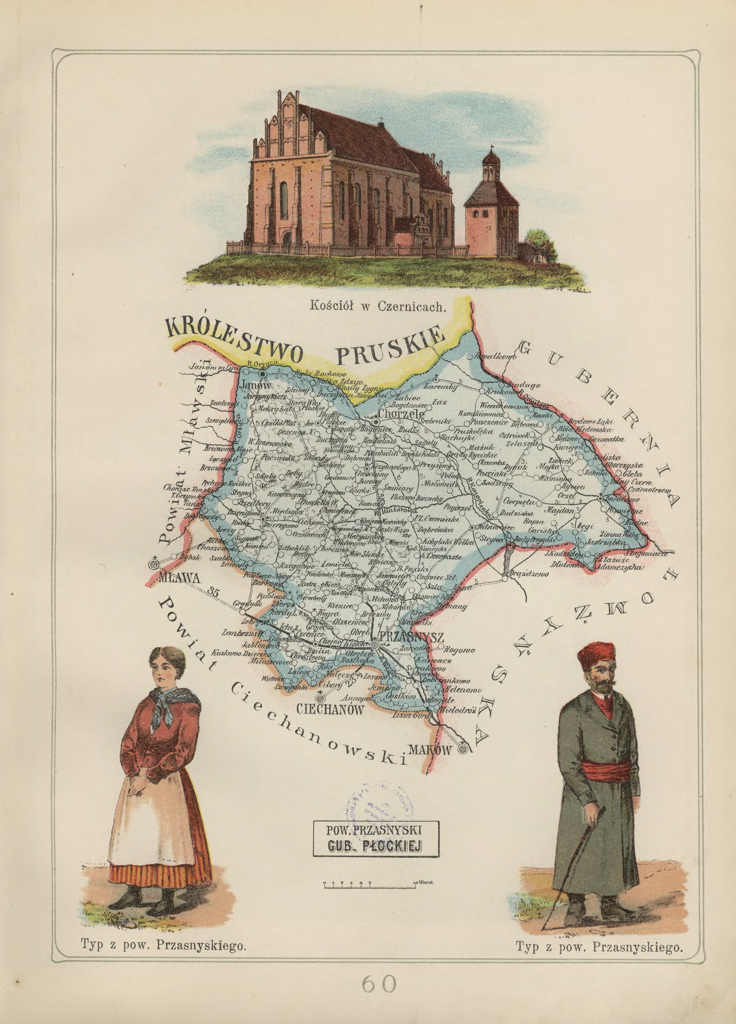
Przasnysz Powiat in the Płock Gubernia – 1907 Józef Michał Bazewicz, Atlas geograficzny ilustrowany Królestwa Polskiego (Litografia B. A. Bukaty, Warsaw, 1907); digital images, Mapywig (http://igrek.amzp.pl/details.php?id=11767111 : accessed 02 February 2019)
The administrative structure of the parishes of Baranowo and Brodowe Łaki can be described as follows:
01 Jul 1569-04 Oct 1795: Village, Ciechanów Ziemia, Masovian Voivodeship, Province of Greater Poland, Polish-Lithuanian Commonwealth
04 Oct 1795-08 Jul 1807:Village, Kammerdepartement Płock, Province of New East Prussia, Kingdom of Prussia
09 Jul 1807-08 Jun 1815: Village, Przasnysz Powiat, Płock Department, Duchy of Warsaw
09 Jun 1815-15 Jan 1816: Village, Przasnysz Powiat, Płock Department, Congress Kingdom of Poland
16 Jan 1816-06 Mar 1837: Village, Przasnysz Obwód, Płock Voivodeship, Congress Kingdom of Poland
07 Mar 1837-10 Nov 1842: Village, Przasnysz Obwód, Płock Gubernia, Congress Kingdom of Poland
11 Nov 1842-07 Sep 1915:Village, Przasnysz Powiat, Płock Gubernia, Congress Kingdom of Poland
08 Sep 1915-10 Nov 1918:Village, Mława Powiat, General Government of Warsaw, German Reich
11 Nov 1918-07 Oct 1939:Village, Przasnysz Powiat, Warsaw Voivodeship, Second Polish Republic
08 Oct 1939-27 Jun 1945:Village, Landkreis Praschnitz, Regierungsbezirk Zichenau, Province of East Prussia, German Reich
28 Jun 1945-21 Jul 1952:Village, Przasnysz Powiat, Warsaw Voivodeship, Republic of Poland
22 Jul 1952-31 May 1975: Village, Przasnysz Powiat, Warsaw Voivodeship, Polish People’s Republic
01 Jun 1975-30 Dec 1989:Village, Ostrołęka Voivodeship, Polish People’s Republic
31 Dec 1989-30 Dec 1998:Village, Ostrołęka Voivodeship, Third Polish Republic
31 Dec 1998-Present:Village, Ostrołęka Powiat, Masovian Voivodeship, Third Polish Republic
The administrative structure of the parishes of Bogate, Chorzele, Duczymin, Jednorożec, Krzynowłoga Mała, Krzynowłoga Wielka, Parciaki, Przasnysz, Święte Miejsce, and Zaręby can be described as follows:
01 Jul 1569-04 Oct 1795: Village, Ciechanów Ziemia, Masovian Voivodeship, Province of Greater Poland, Polish-Lithuanian Commonwealth
04 Oct 1795-08 Jul 1807:Village, Kammerdepartement Płock, Province of New East Prussia, Kingdom of Prussia
09 Jul 1807-08 Jun 1815: Village, Przasnysz Powiat, Płock Department, Duchy of Warsaw
09 Jun 1815-15 Jan 1816: Village, Przasnysz Powiat, Płock Department, Congress Kingdom of Poland
16 Jan 1816-06 Mar 1837: Village, Przasnysz Obwód, Płock Voivodeship, Congress Kingdom of Poland
07 Mar 1837-10 Nov 1842: Village, Przasnysz Obwód, Płock Gubernia, Congress Kingdom of Poland
11 Nov 1842-07 Sep 1915:Village, Przasnysz Powiat, Płock Gubernia, Congress Kingdom of Poland
08 Sep 1915-10 Nov 1918:Village, Mława Powiat, General Government of Warsaw, German Reich
11 Nov 1918-07 Oct 1939:Village, Przasnysz Powiat, Warsaw Voivodeship, Second Polish Republic
08 Oct 1939-27 Jun 1945:Village, Landkreis Praschnitz, Regierungsbezirk Zichenau, Province of East Prussia, German Reich
28 Jun 1945-21 Jul 1952:Village, Przasnysz Powiat, Warsaw Voivodeship, Republic of Poland
While in Salt Lake City at the National Genealogical Society’s Family History Conference last week, I seized the opportunity to conduct some research in the Family History Library. My primary research objective was to identify the administrative divisions for parishes in the area north of Warsaw where my Burski, Chodkowski,  Czarzasty,Kamiński, Klonowski,Krzyczkowski, Milewski, Mossakowski, Niedziałkowski, Rembowski, Skierbowski,Smoleński, Ślaski, and Zaboklicki ancestors lived.
The Family History Library catalog classifies places according to the administrative divisions at the beginning of the 20th century, a time when most of our Polish ancestors immigrated to the United States. One advantage of this classification system is that it corresponds to the time when the Słownik Geograficzy Królestwa Polskiego was written and when the 1907 Map of the Kingdom of Poland was drawn.
My goal in the Family History Library was to examine the civil registration records in these parishes in order to identify the administrative divisions to which the parishes belonged in five time periods: 1807-1815, 1815-1816, 1816-1837, 1837-1844, and 1844-1867. To do this, I really only needed to look at the records for the year 1808, since the administrative divisions for this part of Poland in all these time periods can be deduced fairly easily from the administrative structure in 1808.
Typically, only the civil registration records from 1808-1825 included the names of the administrative divisions in the records themselves. During this time, the names of the administrative divisions changed from powiats and departments to obwóds and voivodeships, and so I checked the registers for a number of years throughout this time period just to verify that my conclusions about the names were correct.
While in Salt Lake City, I was able to examine at least some parishes in each of the following powiats:
My three part series, A Beginner’s Guide to Eastern European Genealogy has proven to be quite popular. Many thanks to Randy Seaver of the GeneaMusings blog for including the series in his “Best of the Genea-Blogs – April 18-24, 2010” post.
Because of its popularity, I’ve converted the three posts to a PDF publication which can be downloaded by clicking the link below.
When genealogists enter the names of the locations where events in their ancestors’ lives occurred, they are faced with the dilemma of how to enter place names so as to unambiguously identify the locations in both space and time.
Because the borders of Poland changed so often throughout history, genealogists may find that correctly identifying the name of the places where vital events in the lives of their ancestors occurred may be a difficult task if they attempt to enter the names of the places as they were known at the time of the events.
Many genealogists simplify the matter by entering the place names as they are known today, by entering the place names as they were known at the end of the 19th century / beginning of the 20th century (when their ancestors arrived in the United States), or simply by entering the name of the village with the nation identified as “Poland”.
Entering the place names as they are known today suffers from the disadvantage that, when the administrative divisions change again, all the place names previously entered will be incorrect. Entering the place names as they were known at the end of the 19th century / beginning of the 20th century fails to account for the fact that the place names changed during the lives of our ancestors. Entering the place names simply as Name of Village, Poland often does not provide enough information to clearly identify the place, especially when the name of the village is common, such as Nowa Wieś, Stare Miasto, or Grądi.
Many genealogists feel that the best way to identify a place in space and time is to list the place name as it was known at the time of the event. By doing so, the genealogist not only identifies the place unambiguously, but also adds valuable historic context to the event by describing the geopolitical landscape at the time of the event. And so, I have decided to take this approach in identifying the places where my own ancestors lived.
My 4th great grandfather, Tomasz Niedziałkowski, was born in the Polish-Lithuanian Commonwealth. Several of his children were born in Prussia, but his youngest child, my 3rd great grandfather Antoni Niedziałkowski, was born in the Duchy of Warsaw. Wojciech Niedziałkowski, my 2nd great grandfather, was born in the Congress Kingdom of Poland as was my 1st great grandfather, Teofil Niedziałkowski. My grandfather, Kostanty (Konstanty) Niedziałkowski, was born in the Russian Empire. My Niedziałkowski ancestors were born in five different countries even though they were all born in the same general area of Poland. These border changes provide information about their lives that would be lost if I did not record the place names as they were at the times of the events.
For this reason, I wrote several posts on how the administrative structure of Poland affected the place names throughout history. This work is still incomplete, especially for those parts of Poland that were annexed by Austria and Prussia. Nonetheless, I have described this work-in-progress to identify the place names as they were throughout Polish history in the following articles:
This is just a start in my effort to correctly identify the names of the places where the vital events in my ancestors’ lives occurred, as they were known at the time of the events.