
The Słownik Geograficzny Królestwa Polskiego i Innych Krajów Słowiańskich (Geographical Dictionary of the Kingdom of Poland and other Slavonic Countries) includes an entry for the Polish village of Czystohorb (now known as Czystogarb).
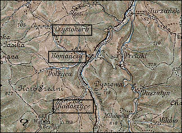
Czystohorb and Surrounding Area – 1910
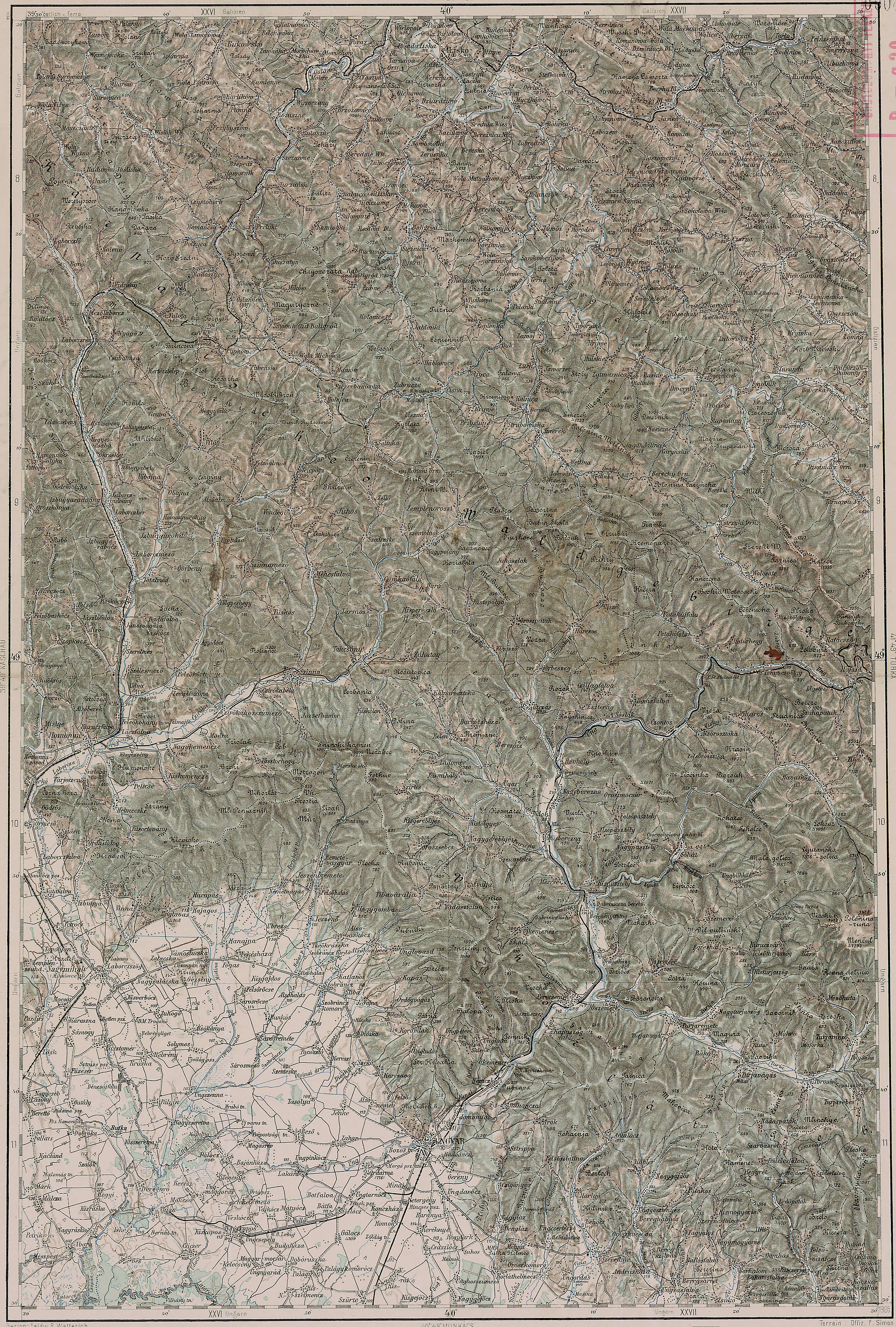
Third Military Mapping Survey of Austria-Hungary (ELTE Faculty of Informatics,
Institute of Cartography and Geoinformatics); digital images, Lazarus ELTE
(http://lazarus.elte.hu/hun/digkonyv/topo/200e/40-50.jpg: accessed 17 December 2025)
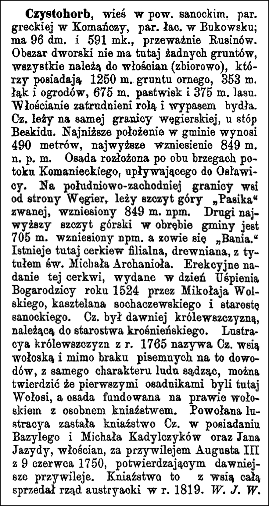
Source: Sulmierski, Filip, Bronisław Chlebowski, and Władysław Walewski, eds., Słownik Geograficzny Królestwa Polskiego i Innych Krajów Słowiańskich (Geographical Dictionary of the Kingdom of Poland and other Slavonic Countries) – Warsaw 1880, Volume I, page 886.
Click on the link for a PDF copy of the first Słownik Geograficzny entry for Czystohorb. Translated from the Polish, the entry reads:
Czystohorb, [now known as Czystogarb] a village in the Sanok powiat, Greek Catholic parish in Komańcza, Roman Catholic parish in Bukowsko; it has 96 houses and 591 inhabitants, mostly Ruthenians. The manor estate does not own any land here; all land belongs to the villagers (collectively), who own 1250 mórgs of arable land, 358 mórgs of meadows and gardens, 675 mórgs of pastures, and 375 mórgs of forest. The villagers are engaged in agriculture and cattle grazing. Czystohorb lies on the very Hungarian border, at the foot of the Beskid Mountains. The lowest point in the commune is 490 meters above sea level; the highest elevation is 849 meters above sea level. The settlement is spread along both banks of the Komańcza stream, which flows into the Osławica river. On the southwestern border of the village, on the Hungarian side, lies the peak of the mountain called “Pasika,” rising to 849 meters above sea level. The second highest mountain peak within the commune is 705 meters above sea level and is called “Bania.” There is a filial wooden church here, dedicated to St. Michael the Archangel. The founding charter for this church was issued on the day of the Dormition [Death and Assumption] of the Mother of God in 1524 by Mikołaj Wolski, castellan of Sochaczew and starost of Sanok. Czystohorb was formerly a royal estate belonging to the Krosno starosty [a storost was a senior administrative official]. The royal estate survey of 1765 calls Czystohorb a Wallachian village, and despite the lack of written evidence, judging from the character of the people, it can be argued that the first settlers here were Wallachians, and the settlement was founded under Wallachian law with a separate principality. The inspection that was carried out found the principality of Czystohorb in the possession of Basil and Michael Kadylczyk and John Jazydy, peasants, by virtue of a privilege granted by Augustus III on June 9, 1750, confirming earlier privileges. The Austrian government sold this principality, along with the entire village, in 1819. W. J. W.
Copyright © 2025 by Stephen J. Danko


