
According to the Słownik Geograficzny Królewstwa Polskiego (Volume 2, published in 1881), the parish of Dylągowa served the villages of Borownica (part of Jawornik Ruski until World War II), Dąbrówka Starzeńska, Dylągowa, Huta Poręby, Jasionów (part of Huta Poręby), Jawornik Ruski, Pawłokoma, Pracówka (part of Żohatyn), Siedliska, Sielnica, Wołodż, and Żohatyn.
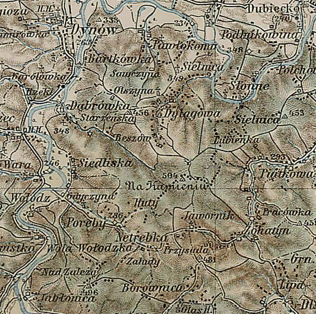
Dylągowa Parish – 1910
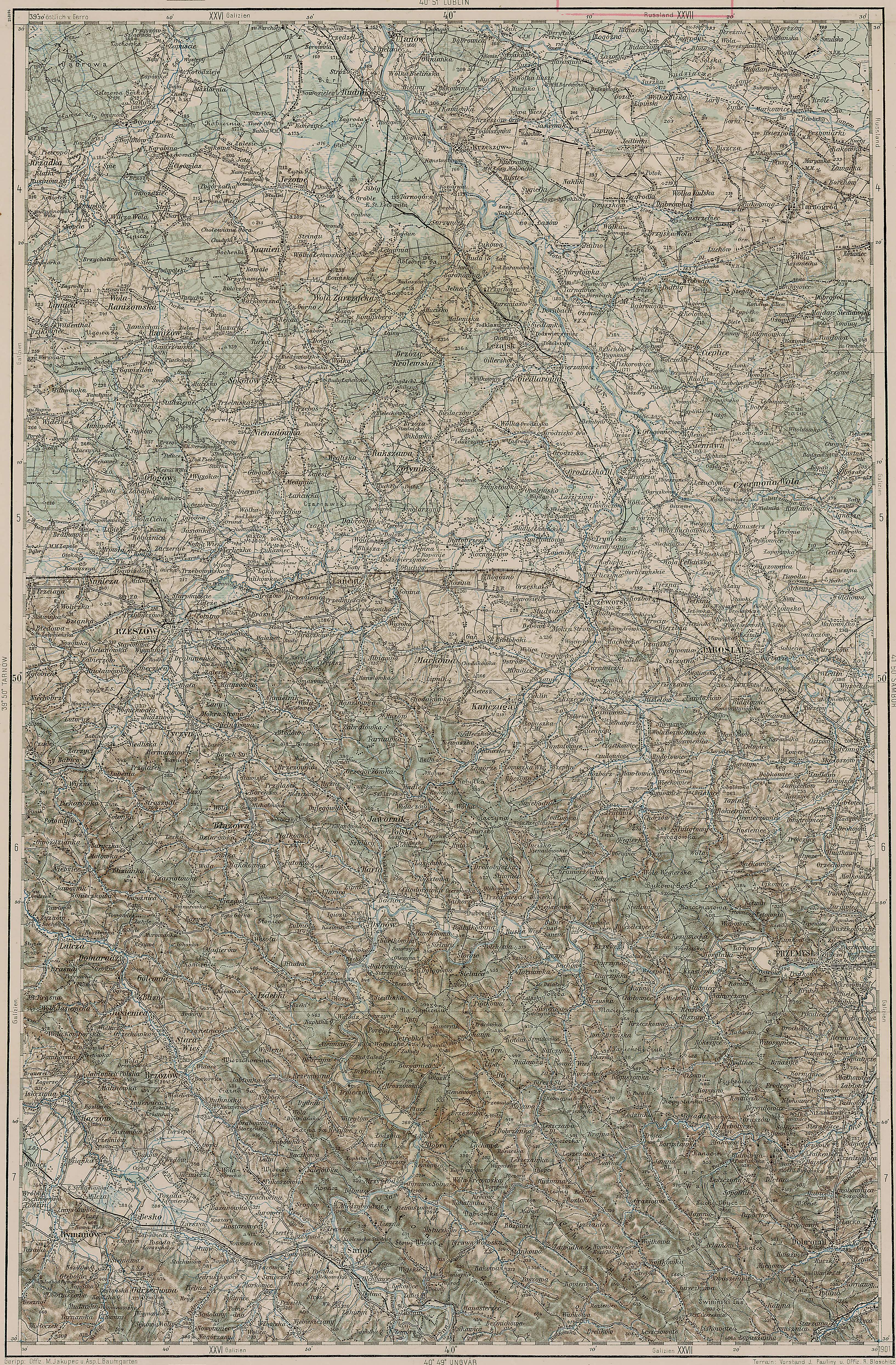
Third Military Mapping Survey of Austria-Hungary (ELTE Faculty of Informatics,
Institute of Cartography and Geoinformatics); digital images, Lazarus ELTE
(http://lazarus.elte.hu/hun/digkonyv/topo/200e/40-50.jpg: accessed 02 October 2025)
The administrative structure to which Dąbrówka Starzeńska, Dylągowa, and Pawłokoma belonged evolved as follows:
- 01 Jul 1569-22 Sep 1772: Village, Sanok Powiat, Sanok Ziemia, Ruthenian Voivodeship, Polish-Lithuanian Commonwealth
- 22 Sep 1772- Nov 1773: Village, Kingdom of Galicia and Lodomeria, Habsburg Monarchy
- Nov 1773-Nov 1777: Village, Kreis Red Ruthenia, Kingdom of Galicia and Lodomeria, Habsburg Monarchy
- Nov 1777-21 Mar 1782: Village, Kreisdistrikt Przemyśl, Kreis Sambor, Kingdom of Galicia and Lodomeria, Habsburg Monarchy
- 22 Mar 1782-11 Aug 1804: Village, Kreis Sanok, Kingdom of Galicia and Lodomeria, Habsburg Monarchy
- 11 Aug 1804-Mar 1854: Village, Kreis Sanok, Kingdom of Galicia and Lodomeria, Austrian Empire
- Apr 1854-28 Mar 1867: Village, Kreis Sanok, Lemberg Administrative Area, Kingdom of Galicia and Lodomeria, Austrian Empire
- 30 Mar 1867-10 Nov 1918: Village, Bezirk Brzozów, Kingdom of Galicia and Lodomeria, Austria-Hungary
- 11 Nov 1918-20 Oct 1939: Village, Brzozów Powiat, Lwów Voivodeship, Second Polish Republic
- 21 Oct 1939-31 Aug 1941: Village, Ukrainian SSR, Union of Soviet Socialist Republics
- 01 Sep 1941-27 Jun 1945: Village, District of Kraków, General Government, Nazi Germany
- 28 Jun 1945-21 Jul 1952: Village, Brzozów Powiat, Rzeszów Voivodeship, Republic of Poland
- 22 Jul 1952-31 May 1975: Village, Brzozów Powiat, Rzeszów Voivodeship, Polish People’s Republic
- 01 Jun 1975-30 Dec 1989: Village, Przemyśl Voivodeship, Polish People’s Republic
- 31 Dec 1989-30 Dec 1998: Village, Przemyśl Voivodeship, Third Polish Republic
- 31 Dec 1998-Present: Village, Rzeszów Powiat, Subcarpathian Voivodeship, Third Polish Republic
The administrative structure to which Sielnica belonged evolved as follows:
- 01 Jul 1569-22 Sep 1772: Village, Sanok Powiat, Sanok Ziemia, Ruthenian Voivodeship, Polish-Lithuanian Commonwealth
- 22 Sep 1772- Nov 1773: Village, Kingdom of Galicia and Lodomeria, Habsburg Monarchy
- Nov 1773-Nov 1777: Village, Kreis Red Ruthenia, Kingdom of Galicia and Lodomeria, Habsburg Monarchy
- Nov 1777-21 Mar 1782: Village, Kreisdistrikt Przemyśl, Kreis Sambor, Kingdom of Galicia and Lodomeria, Habsburg Monarchy
- 22 Mar 1782-11 Aug 1804: Village, Kreis Sanok, Kingdom of Galicia and Lodomeria, Habsburg Monarchy
- 11 Aug 1804-Mar 1854: Village, Kreis Sanok, Kingdom of Galicia and Lodomeria, Austrian Empire
- Apr 1854-28 Mar 1867: Village, Kreis Sanok, Lemberg Administrative Area, Kingdom of Galicia and Lodomeria, Austrian Empire
- 30 Mar 1867-10 Nov 1918: Village, Bezirk Przemyśl, Kingdom of Galicia and Lodomeria, Austria-Hungary
- 11 Nov 1918-20 Oct 1939: Village, Przemyśl Powiat, Lwów Voivodeship, Second Polish Republic
- 21 Oct 1939-31 Aug 1941: Village, Ukrainian SSR, Union of Soviet Socialist Republics
- 01 Sep 1941-27 Jun 1945: Village, District of Kraków, General Government, Nazi Germany
- 28 Jun 1945-21 Jul 1952: Village, Przemyśl Powiat, Rzeszów Voivodeship, Republic of Poland
- 22 Jul 1952-31 May 1975: Village, Przemyśl Powiat, Rzeszów Voivodeship, Polish People’s Republic
- 01 Jun 1975-30 Dec 1989: Village, Przemyśl Voivodeship, Polish People’s Republic
- 31 Dec 1989-30 Dec 1998: Village, Przemyśl Voivodeship, Third Polish Republic
- 31 Dec 1998-Present: Village, Przemyśl Powiat, Subcarpathian Voivodeship, Third Polish Republic
The administrative structure to which Borownica, Jawornik Ruski, Pracówka (part of Żohatyn), and Żohatyn belonged evolved as follows:
- 01 Jul 1569-22 Sep 1772: Village, Sanok Powiat, Sanok Ziemia, Ruthenian Voivodeship, Polish-Lithuanian Commonwealth
- 22 Sep 1772- Nov 1773: Village, Kingdom of Galicia and Lodomeria, Habsburg Monarchy
- Nov 1773-Nov 1777: Village, Kreis Red Ruthenia, Kingdom of Galicia and Lodomeria, Habsburg Monarchy
- Nov 1777-21 Mar 1782: Village, Kreisdistrikt Przemyśl, Kreis Sambor, Kingdom of Galicia and Lodomeria, Habsburg Monarchy
- 22 Mar 1782-11 Aug 1804: Village, Kreis Sanok, Kingdom of Galicia and Lodomeria, Habsburg Monarchy
- 11 Aug 1804-Mar 1854: Village, Kreis Sanok, Kingdom of Galicia and Lodomeria, Austrian Empire
- Apr 1854-28 Mar 1867: Village, Kreis Sanok, Lemberg Administrative Area, Kingdom of Galicia and Lodomeria, Austrian Empire
- 30 Mar 1867-29 Sep 1876: Village, Bezirk Bircza, Kingdom of Galicia and Lodomeria, Austria-Hungary
- 30 Sep 1876-10 Nov 1918: Village, Bezirk Dobromil, Kingdom of Galicia and Lodomeria, Austria-Hungary
- 11 Nov 1918-20 Oct 1939: Village, Dobromil Powiat, Lwów Voivodeship, Second Polish Republic
- 21 Oct 1939-31 Aug 1941: Village, Ukrainian SSR, Union of Soviet Socialist Republics
- 01 Sep 1941-27 Jun 1945: Village, District of Kraków, General Government, Nazi Germany
- 28 Jun 1945-21 Jul 1952: Village, Przemyśl Powiat, Rzeszów Voivodeship, Republic of Poland
- 22 Jul 1952-31 May 1975: Village, Przemyśl Powiat, Rzeszów Voivodeship, Polish People’s Republic
- 01 Jun 1975-30 Dec 1989: Village, Przemyśl Voivodeship, Polish People’s Republic
- 31 Dec 1989-30 Dec 1998: Village, Przemyśl Voivodeship, Third Polish Republic
- 31 Dec 1998-Present: Village, Przemyśl Powiat, Subcarpathian Voivodeship, Third Polish Republic
The administrative structure to which Huta Poręby, Jasionów (part of Huta Poręby), Siedliska, and Wołodż belonged evolved as follows:
- 01 Jul 1569-22 Sep 1772: Village, Sanok Powiat, Sanok Ziemia, Ruthenian Voivodeship, Polish-Lithuanian Commonwealth
- 22 Sep 1772- Nov 1773: Village, Kingdom of Galicia and Lodomeria, Habsburg Monarchy
- Nov 1773-Nov 1777: Village, Kreis Red Ruthenia, Kingdom of Galicia and Lodomeria, Habsburg Monarchy
- Nov 1777-21 Mar 1782: Village, Kreisdistrikt Przemyśl, Kreis Sambor, Kingdom of Galicia and Lodomeria, Habsburg Monarchy
- 22 Mar 1782-11 Aug 1804: Village, Kreis Sanok, Kingdom of Galicia and Lodomeria, Habsburg Monarchy
- 11 Aug 1804-Mar 1854: Village, Kreis Sanok, Kingdom of Galicia and Lodomeria, Austrian Empire
- Apr 1854-28 Mar 1867: Village, Kreis Sanok, Lemberg Administrative Area, Kingdom of Galicia and Lodomeria, Austrian Empire
- 30 Mar 1867-10 Nov 1918: Village, Bezirk Brzozów, Kingdom of Galicia and Lodomeria, Austria-Hungary
- 11 Nov 1918-20 Oct 1939: Village, Brzozów Powiat, Lwów Voivodeship, Second Polish Republic
- 21 Oct 1939-31 Aug 1941: Village, Ukrainian SSR, Union of Soviet Socialist Republics
- 01 Sep 1941-27 Jun 1945: Village, District of Kraków, General Government, Nazi Germany
- 28 Jun 1945-21 Jul 1952: Village, Brzozów Powiat, Rzeszów Voivodeship, Republic of Poland
- 22 Jul 1952-31 May 1975: Village, Brzozów Powiat, Rzeszów Voivodeship, Polish People’s Republic
- 01 Jun 1975-30 Dec 1989: Village, Krosno Voivodeship, Polish People’s Republic
- 31 Dec 1989-30 Dec 1998: Village, Krosno Voivodeship, Third Polish Republic
- 31 Dec 1998-Present: Village, Brzozów Powiat, Subcarpathian Voivodeship, Third Polish Republic
Copyright © 2025 by Stephen J. Danko


