
One of the places that appear in the records of my Suwiński relatives was called Gogole. There are two brief records of this village in the Słownik Geograficzny Królestwa Polskiego i Innych Krajów Słowiańskich (Geographical Dictionary of the Kingdom of Poland and other Slavonic Countries).

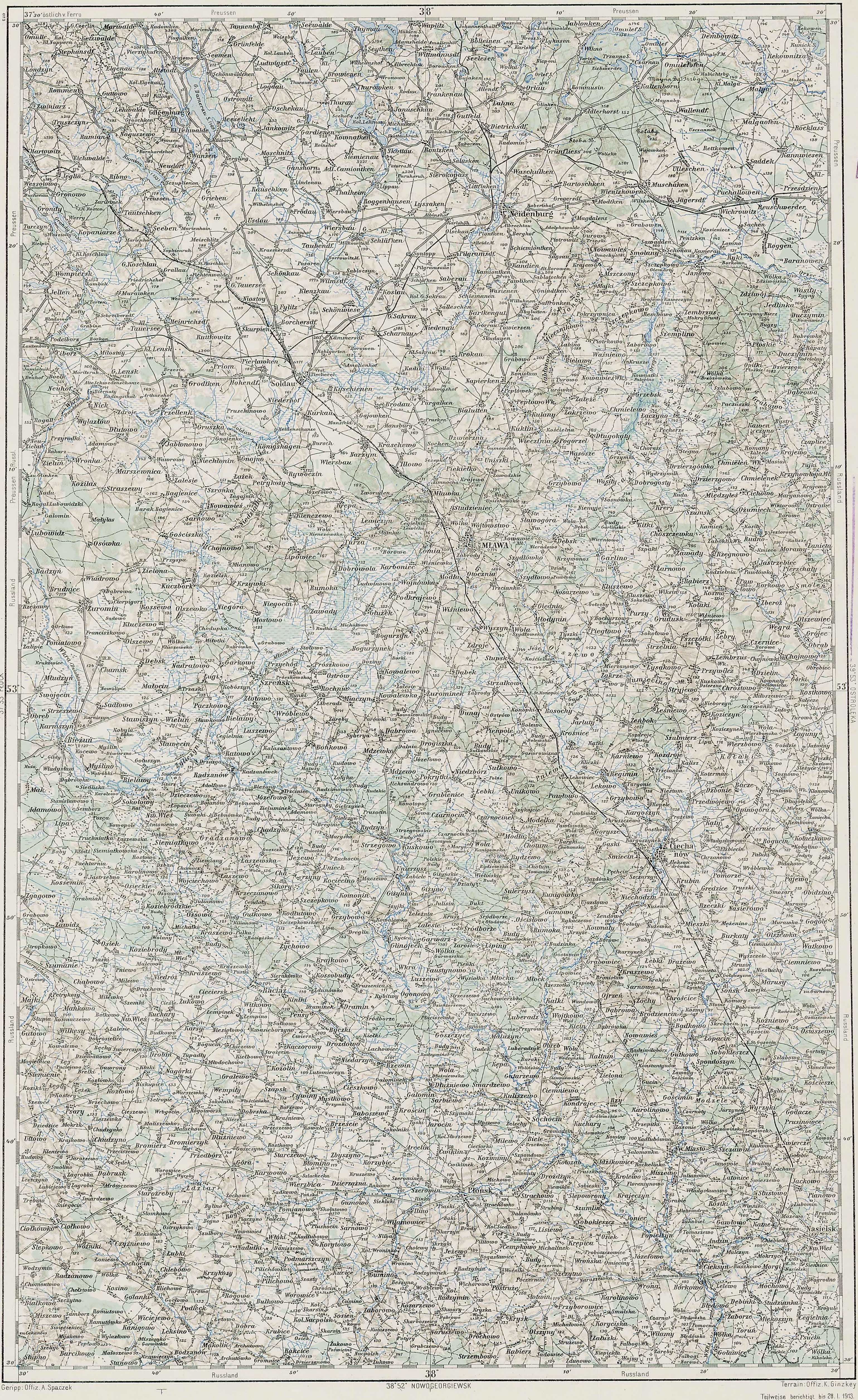
Austrian Military Map of the Gogole Area – 1910
SOURCE: Third Military Mapping Survey of Austria-Hungary, Sheet 38-53, Mława. Online http://lazarus.elte.hu/hun/digkonyv/topo/200e/38-53.jpg; downloaded 21 Dec 2010.

Słownik Geograficzny Entry for Gogole
Source: Sulimierski, Filip, Bronisław Chlebowski, and Władysław Walewski, eds., Słownik Geograficzny Królestwa Polskiego i Innych Krajów Słowiańskich (Geographical Dictionary of the Kingdom of Poland and other Slavonic Countries) – Warsaw 1881, Volume II, pages 648-649.
Click on the link for a PDF copy of the Słownik Geograficzny entry for Gogole. Translated from the Polish, the entry reads:
Gogole-wielkie and Gogole-steczki, two villages in the Ciechanów Powiat, Gołymin Gmina, and Pałuki parish, about 13 versts from Ciechanów and about 5 versts from Pałuki. In 1827 Gogole-wielkie had 20 homes and 133 residents, while Gogole-steczki had 5 homes and 35 residents. Today, Gogole-wielkie has 19 homes, 210 residents, and 151 morgs [in the Russian partition 1 morg = 1.388 acres] of settlements, and Gogole-steczki has 9 homes, 61 residents, and 151 morgs of settlements. In the village of Gogole-wielkie there are a few larger folwarks [large manorial farms].
Gogole, see Dąbrowa, page 923.
Copyright © 2010 by Stephen J. Danko


