
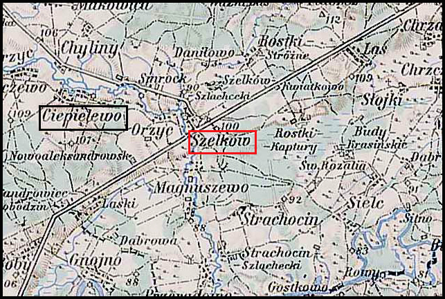
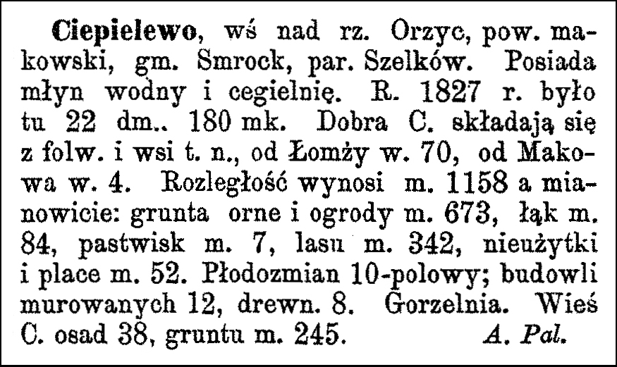
The Słownik Geograficzny Królestwa Polskiego i Innych Krajów Słowiańskich (Geographical Dictionary of the Kingdom of Poland and other Slavonic Countries) includes two entries for the Polish village of Ciepielewo.
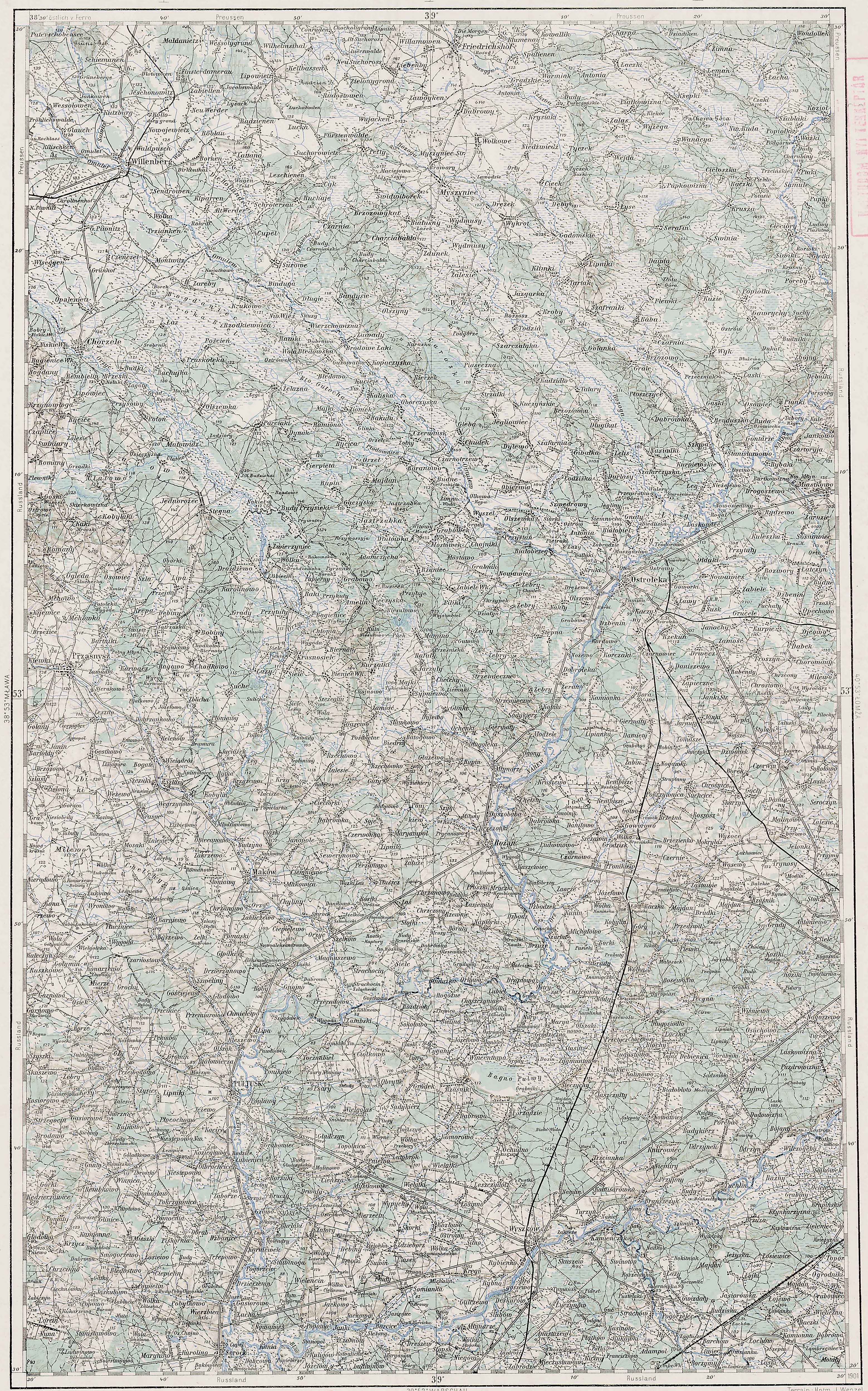
Ciepielewo and Surrounding Area – 1910
Third Military Mapping Survey of Austria-Hungary (ELTE Faculty of Informatics,
Institute of Cartography and Geoinformatics); digital images, Lazarus ELTE
(http://lazarus.elte.hu/hun/digkonyv/topo/200e/39-53.jpg: accessed 20 December 2025)
Source: Sulmierski, Filip, Bronisław Chlebowski, and Władysław Walewski, eds., Słownik
Geograficzny Królestwa Polskiego i Innych Krajów Słowiańskich (Geographical
Dictionary of the Kingdom of Poland and other Slavonic Countries) – Warsaw 1880,
Volume I, Page 689.
Click on the link for a PDF copy of the the Słownik Geograficzny entries for Ciepielewo. Translated from the Polish, the first entry reads:
Ciepielewo, a village on the Orzyc River, Maków powiat, Smrock gmina, Szelków parish. It has a watermill and a brickyard. In 1827, there were 22 houses and 180 inhabitants. The Ciepielewo estate consists of a manor farm and the village of the same name, 70 versts [1 verst = 1.07 kilometers] from Łomża and 4 versts from Maków. Its area is 1158 mórgs [Gerald Ortell’s book on Polish Parish Records states that in the Russian partition 1 mórg = 1.388 acres], specifically: arable land and gardens 673 mórgs, meadows 84 mórgs, pastures 7 mórgs, forest 342 mórgs, unproductive land and building plots 52 mórgs. It uses a 10-field crop rotation system; there are 12 brick buildings and 8 wooden ones. There is also a distillery. The village of Ciepielewo has 38 settlements and 245 mórgs of land. A. Pal.
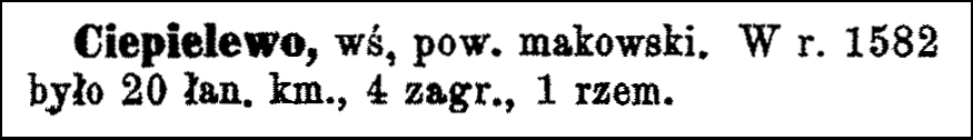
Translated from the Polish, the second entry reads:
Ciepielewo, a village in Maków powiat. In 1582 there were 20 peasant farms, 4 smallholdings, 1 craftsman.
Copyright © 2025 by Stephen J. Danko


