
The Słownik Geograficzny Królestwa Polskiego i Innych Krajów Słowiańskich (Geographical Dictionary of the Kingdom of Poland and other Slavonic Countries) includes entries for three villages called Radoszyce and one entry for Radoszycki stream. The first entry is for a village in Świętokrzyskie Voivodeship. The second and third entries, as well as the stream, are located in Podkarpackie Voivodeship, and it is these entries in Podkarpackie Voivodeship that are described here.
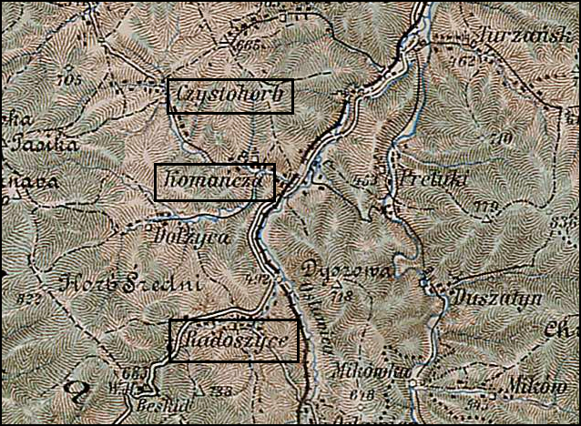
Radoszyce and Surrounding Area – 1910
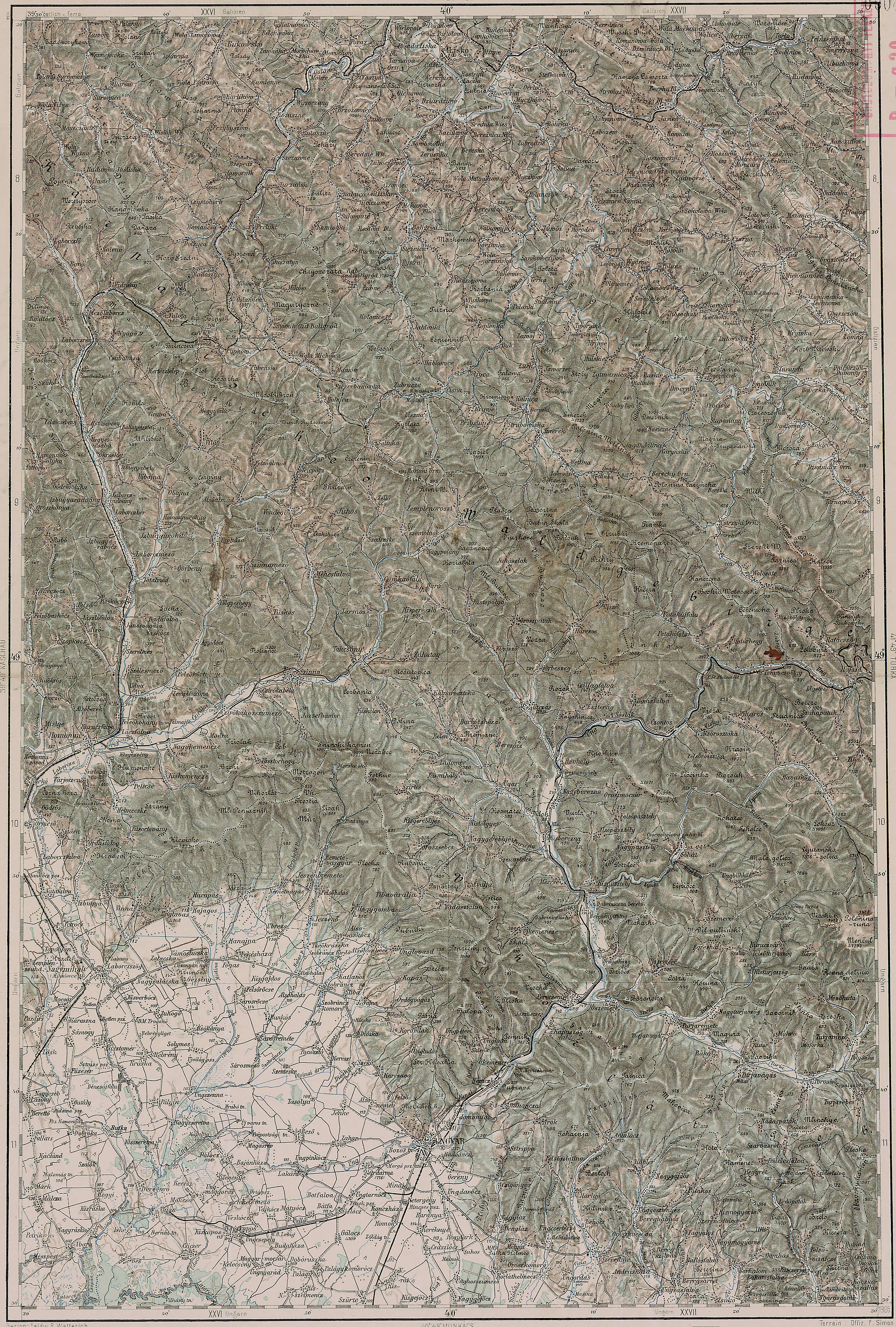
Third Military Mapping Survey of Austria-Hungary (ELTE Faculty of Informatics,
Institute of Cartography and Geoinformatics); digital images, Lazarus ELTE
(http://lazarus.elte.hu/hun/digkonyv/topo/200e/40-50.jpg: accessed 17 December 2025)
Source: Chlebowski, Bronisław, Władysław Walewski, and Filip Sulimierski, eds., Słownik Geograficzny Królestwa Polskiego i Innych Krajów Słowiańskich (Geographical Dictionary of the Kingdom of Poland and other Slavonic Countries) – Warsaw 1888, Volume IX, pages 442-443.
Click on the link for a PDF copy of the first Słownik Geograficzny entries for Radoszyce and Radoszycki potok. Translated from the Polish, the entry reads:
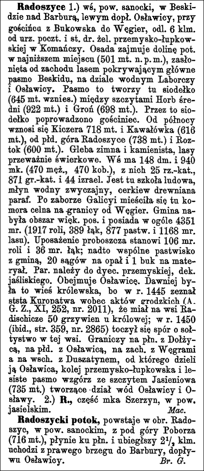
Radoszyce 1.) a village in Sanok County, in the Beskid Mountains on the Barbura stream, a left tributary of the Osławica, on the road from Bukowsko to Hungary, 6 km from the post office and railway station of the Przemyśl-Łupków line in Komańcza. The settlement occupies the valley of the stream at its lowest point (501 meters above sea level), sheltered from the west by a forest covering the main Beskid range, on the watershed between the Laborcza and Osławica rivers. This range forms a saddle here (645 meters elevation) between the peaks of Horb Średni (922 meters) and Groń (698 meters). The main road runs through this saddle. To the north rises Kiczera (718 meters) and Kawałówka (616 meters), to the south Mount Radoszyce (738 meters) and Roztok (600 meters). The soil is cold and stony, the forests are mostly spruce. The village has 148 houses and 940 inhabitants (470 men, 470 women), of whom 25 are Roman Catholic, 871 Greek Catholic, and 44 Jewish. There is a primary school, a watermill, and a wooden parish church. After the annexation of Galicia, a customs office was located here on the border with Hungary. The commune acquired a large estate and owns a total of 4351 mórgs [in Galicia 1 mórg = 1.422 acres] (1917 mórgs of arable land; 389 mórgs of meadows, 877 mórgs of pastures and 1168 mórgs of forest). The parish priest’s endowment consists of 106 mórgs of arable land and 36 mórgs of meadows; in addition, a common pasture with the commune, 20 cords of firewood and 1 beech tree for timber. The parish belongs to the Przemyśl diocese, Jaśliska deanery. It includes Osławica. Formerly, it was a royal village because in 1445 the starost [a kind of district chief or official] Kuropatwa testified before the town court records (A. G. Z., XI, 252, no. 2011) that he owed the queen 50 grzywnas [ancient silver coins, worth several denarii, used in Poland and other countries of Europe] in the village of Radichieze; in 1450 (ibid., p. 359, no. 2865) a dispute over the village headship in this village took place. It borders on the north with Dołżyca, on the south with Osławica, on the west with Hungary, and on the east with Duszatyn, from which it is separated by Osławica, the Przemyśl-Łupków railway line and a wooded range of hills with the Jasieniowa peak (735 meters) forming the watershed between Osławica and Osława. 2.) R., part of the town of Szerzyny, in the Jasło district. M. Maciszewski
Radoszycki stream, originates in the area of Radoszyce, in the Sanok district, from under Mount Poborza (716 meters), flows north and after 2 1/2 kilometes flows into Barbury, a tributary of Osławica, from the right bank. Bronisław Gustawicz
Copyright © 2025 by Stephen J. Danko


