
The village of Węgra is significant in my family history because it was the location where some of my Chodkowski cousins were married.

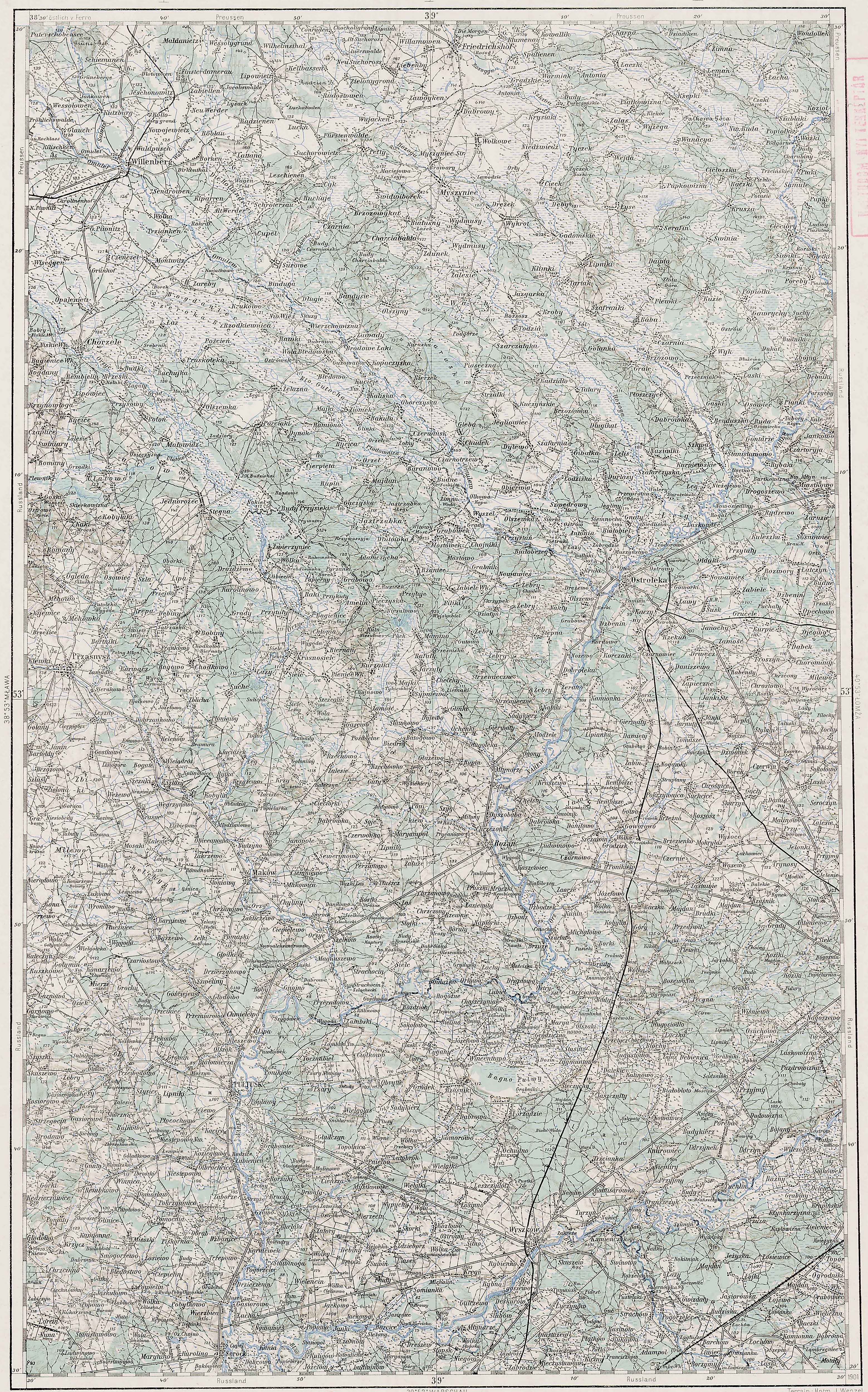
Austrian Military Map of the Węgra Area – 1910
SOURCE: Third Military Mapping Survey of Austria-Hungary, Sheet 38-53, Mława. Online http://lazarus.elte.hu/hun/digkonyv/topo/200e/39-53.jpg; downloaded 25 May 2010.

Słownik Geograficzny Entry for Węgra
Source: Chlebowski, Bronisław, Filip Sulimierski, and Władysław Walewski, eds., Słownik Geograficzny Królestwa Polskiego i Innych Krajów Słowiańskich (Geographical Dictionary of the Kingdom of Poland and other Slavonic Countries) – Warsaw 1893, Volume XIII, page 256.
Click on the link for a PDF copy of the Słownik Geograficzny entry for Węgra. Translated from the Polish, the entry reads:
Węgra, a village and three granges on the Węgierka River in the Przasnysz Powiat, Chojnowo Gmina, and Węgra Parish, 8 ½ versts [0.66 miles per verst] from Przasnysz. It includes a parish church of wood, the municipal offices, a brickyard, 28 homes, 300 residents, and a total area of 1152 morgs [in the Russian partition 1 morg = 1.388 acres]. In the year 1827 there were 26 homes and 212 residents. In the year 1880 the Węgra grange letter A extended 370 morgs: 318 morgs of arable land and gardens, 30 morgs of meadows, 10 morgs of pastures, 11 morgs of wastelands, 1 stone building and 11 wooden buildings. The village of Węgra letter B included 2 settlements and 2 morgs. The Węgra grange letter D extended 371 morgs: 280 morgs of arable land and gardens, 74 morgs of meadows, 9 morgs of pastures, 8 morgs of wastelands, and 11 wooden buildings. The date the church and parish were erected is unknown. They already existed in the year 1567. Bartłomiej Węgierski, the owner of the property, raised the current wooden church in the year 1730. In the year 1567, according to the conscription records, the village consisted of noble parts: two after 2 włóki [one włóka equaled about 16.8 hectares] paid for 5 gardens, 1 włóka for 1 garden, 6 ½ włóki for 3 gardens. (Źródła dziejowe volume XVI, page 340). In the parish which belonged to the Przasnysz Deanery, there were 2600 souls.
                                                 Bronisław Chlebowski
The notation (Źródła dziejowe volume XVI, page 340) refers to:
Pawiński, Adolf. 1892. Mazowsze. Polska XVI wieku pod względem geograficzno-statystycznym, t. 5. Warszawa: skł. gł. w Księgarni Gebethnera i Wolffa.
This publication is available online at the Digital Library of Wielkopolska.
The maps of the Third Military Mapping Survey of Austria-Hungary and the entries in the Słownik Geograficzny were prepared at about the same time and make a good pair for studying places in and around the Congress Kingdom of Poland at the end of the 19th century and beginning of the 20th century, a time period when the Eastern European ancestors of present-day Americans left their homelands for the United States.
Copyright © 2010 by Stephen J. Danko


