In 1657, the Treaty of Bromberg and the Treaty of Wehlau had given full sovereignity to the Duchy of Prussia, which had formerly been a fief of the Crown of Poland. On 18 January 1771, Frederick III, elector of Brandenburg, crowned himself King in Prussia (rather than King of Prussia, in deference to the historic ties to the Crown of Poland). Thus, prior to the partitions of Poland, the Prussian state was called the Kingdom in Prussia, and not until 1772, was it called the Kingdom of Prussia.
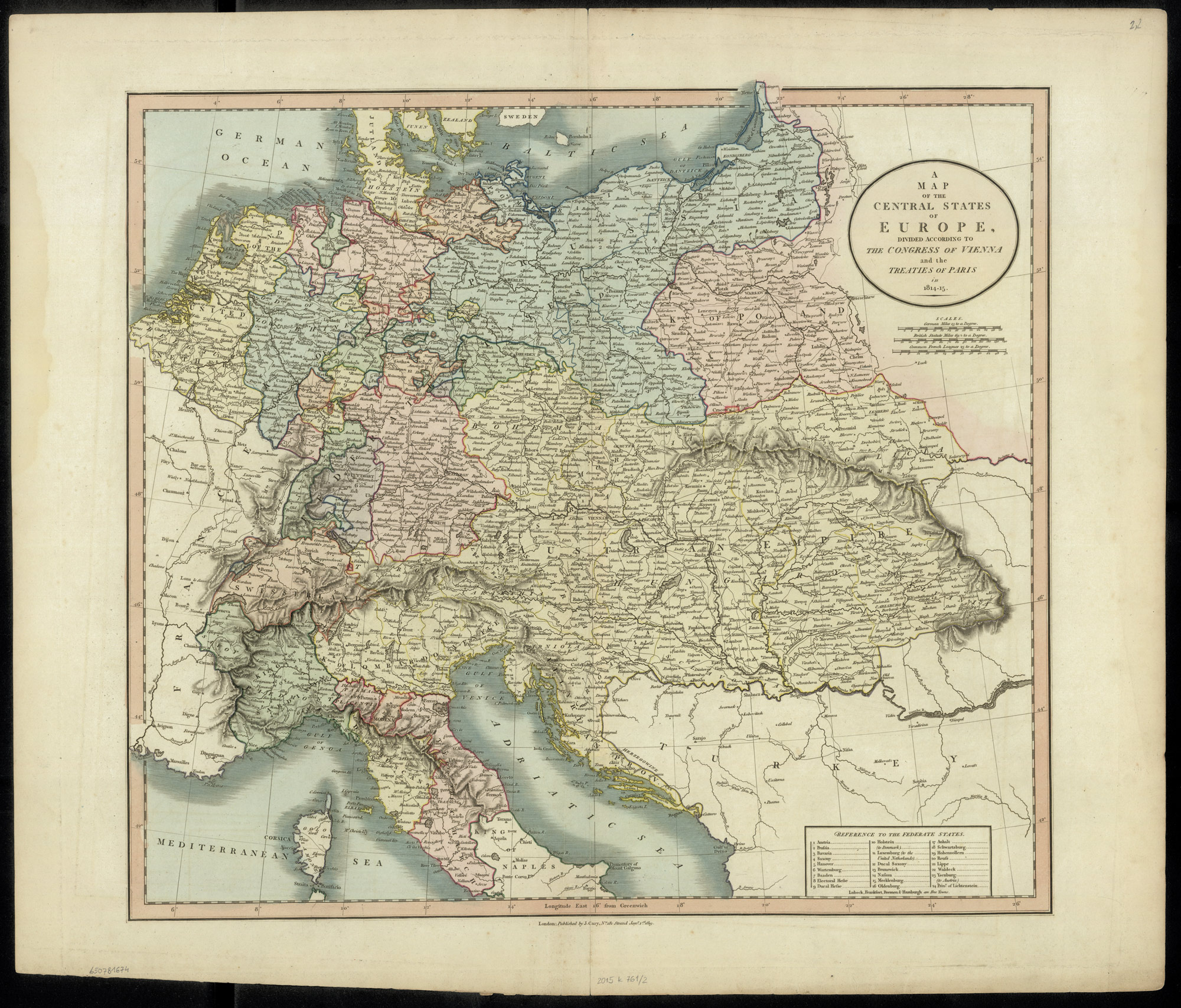
During the three partitions of Poland by Russian, Prussia, and Austria in the years 1772, 1793, and 1795, the Kingdom in Prussia acquired substantial territory from the former Polish-Lithuanian Commonwealth. The map below, Kingdom in Prussia Prior to the Partitions of Poland (1701-1772), shows the extent of the Kingdom in Prussia in shades of pink. Territories belonging to the Crown of Poland are shown in shades of green.
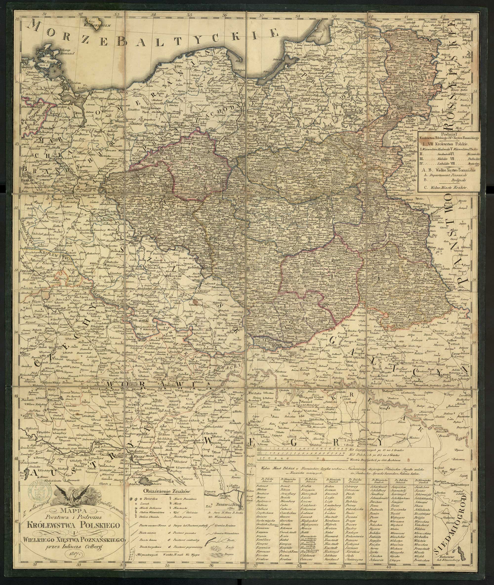
Territories in the map below include the following divisions of the Kingdom in Prussia:
- Circulus Hockerlandiae (Hockerland Kreis)
- Pogesamia Hockerlandia (Pogesania)
- Pomesania (Pomesania)
- Circulus Natangiensis (Natangia Kreis)
- Bartonia (Bartia)
- Galindia (Galindia)
- Natangia (Natangia)
- Sudavia (Sudovia)
- Circulus Sambiensis (Sambia Kreis)
- Nadrovia (Nadrovia)
- Samlandia (Samland/Sambia)
- Sclavonia (Scalovia)
Territories in the map below include the following divisions of the Kingdom in the Crown of Poland:
- Palatinatus Pomerelia (Pomeranian Voivodeship)
- Territ Dersaviense (?)
- Territorium Mirachoviense (Mirachowo)
- Territorium Puschense (Puck)
- Territorium Sluchoviense (Człuchów)
- Territorium Suecense (Świecie)
- Territo Tucholiense (Tuchola)
- Territorium Zucoviense (Żukowo)
- Palatinat Culmiensis (Chełmno Voivodeship)
- Culm (Chełmno)
- Michelavia (Michałowo)
- Palatinat Marienburgensis (Malbork Voivodeship)
- Marienburg (Malbork)
- Varmia/Ermelandia (Warmia/Ermland)
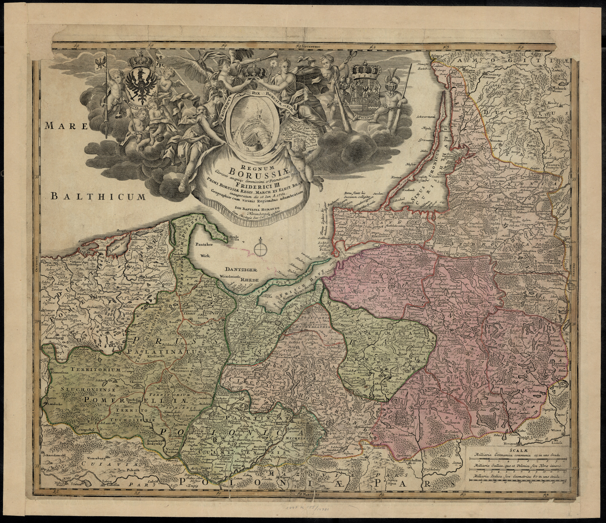
Kingdom in Prussia Prior to the Partitions of Poland (1701-1772)
Johann Christoph Reinsperger, Regnum Borussiae Gloriosis auspicijs Serenissimi et Potentissimi Prin. Friderici III Primi Borussiae Regis. March. et Elect. Bran. inauguratum die 18. Ian. A. 1701 : geographice cum vicinis Regionibus adumbratum (Homanniani Heredes, Nuremburg, After 1740); digital images, Polona Digital Library (http://polona.pl/item/44994135/ : accessed 13 January 2019).
In 1772, the Kingdom in Prussia acquired the territory of Royal Prussia (which had been a region of the Polish-Lithuanian Commonwealth since 1569) and the northern part of the Province of Greater Poland, except for the cities of Gdańsk (Danzig), and Toruń (Thorn).
In 1773, the voivodeships of Pomerania, Chełmno, and Marlbork, all formerly part of Royal Prussia, were merged with the Kingdom in Prussia to form the Province of West Prussia. The northern parts of the Poznań and the Kalisz voivodeships, and the western part of the Inowrocław voivodeship also were incorporated into the Province of West Prussia. In addition, the Archbishopric of Warmia (Ermland) was incorporated into the Province of East Prussia.
In 1793, Prussia acquired the cities of Gdańsk (Danzig) and Toruń (Thorn), as well as the rest of the Province of Greater Poland. The voivodeships of Brześć Kugawski, Gniezno, Inowrocław, Kalisz, Łęczyca, Płock, Poznań, Sieradz, and parts of the voivodeships of Kraków, Masovia, and Rawa became the Province of South Prussia.
In 1795, Prussia acquired the Ciechanów and Masovia voivodeships, and parts of the Brześć, Grodno, Merecz, Podlaski, Troki, and Warsaw voivodeships which had only recently been created in 1793 at the Grodno Sejm. These territories became the Province of New East Prussia. Prussia also acquired the northern part of the Kraków voivodeship and named it New Silesia.
Daniel Friedrich Sotzmann, General Karte von Ost-West-Sí¼d und Neu-Ostpreussen, dem Grenz-Tractate vom Jahre 1797… (S. Schropp, Berlin, 1798); digital images, Gallica Digital Library (https://gallica.bnf.fr/ark:/12148/btv1b53027522v : accessed 12 January 2019).
The Province of East Prussia was divided into the following Departments and Kreise:
- Königsberg Department (Kreise: Brandenburg, Braunsberg (Ermland), Heilsberg (Ermland), Mohrungen (Ermland), Neidenburg, Rastenburg, Samland, and Tapiau)
- Gumbinnen (Gusev) Department (Kreise: Gumbinnen, Insterburg, Memel, Olecko, Ragnit, Seehesten (Sensburg), and Tilsit)
The Province of New East Prussia was divided into the following Departments and Kriese:
- Bialystok Department (Kreise: Bialystok, Bielsk, Bobrz, Dombrowa, Drohiczyn, Kalwary, Lomza, Mariampol, Surasz, and Wigry)
- Plock Department (Kreise: Lipno, Mlawa, Ostrolenka, Plozk, Pultusk, Wyszogrod)
The Province of South Prussia was divided into the following Departments and Kreise:
- Kalisch Department (Kreise: Adelnau, Czenstochau, Kalisch, Konin, Lumtomiersk, Ostreschow, Petrikau, Radomsk, Schadeck, Sieradz, Warta, and Wieluń)
- Posen Department (Kreise: Bomst, Brzesk, Fraustadt, Gnesen, Kosten, Kowal, Krebe, (later Kröben), Krotoschin, Meseritz, Oborniki, Peisern, Posen, Powitz, Radziejów, Schrimm, Schroda, and Wangrowitz)
- Warschau Department (Kreise: Blonin, Brzezin, Gostin, Lenczyca, Orlow, Rawa, Sochaczew, Tschersk, Warschau, and Zgierz)
The Province of West Prussia was divided into the following Departments and Kreise:
- Bromberg Department (Kreise: Berent, Danzig, Danziger Höhe, Danziger Niederung, Dirschau, Elbing, Karthaus, Marienburg, Neustadt in Westprussia, Putzig, and Stargard)
- Marienwerder Department (Kreise: Briesen, Deutsch Krone, Flatow, Graudenz, Konitz, Kulm, Löbau, Marienwerder, Rosenberg, Schlochau, Schwetz, Strasburg in Westprussia, Stuhm, Thorn, and Tuchel)
These divisions lasted only until the Treaties of Tilsit were signed on 07 July 1807 and on 09 July 1807.
Copyright © 2019 by Stephen J. Danko