
The village of Niesiobędy is significant in my family history because it was the location where some distant Grabowski relatives lived.

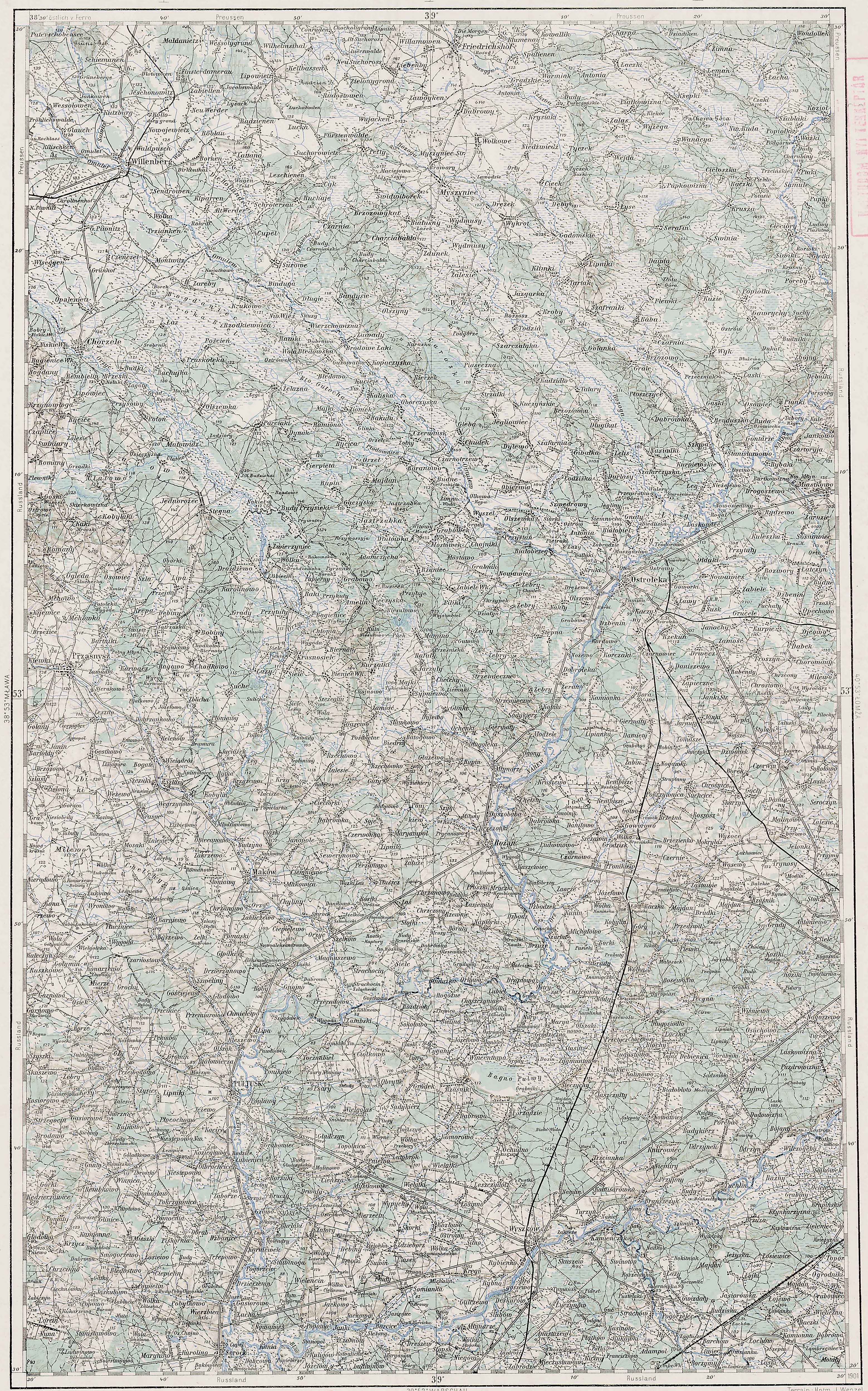
Austrian Military Map of the Niesiobędy Area – 1910
SOURCE: Third Military Mapping Survey of Austria-Hungary, Sheet 39-53, Ostrolecka. Online http://lazarus.elte.hu/hun/digkonyv/topo/200e/39-53.jpg; downloaded 19 May 2010.

Słownik Geograficzny Entry for Niesiobędy
Source: Chlebowski, Bronisław, Władysław Walewski, and Filip Sulimierski, eds., Słownik Geograficzny Królestwa Polskiego i Innych Krajów Słowiańskich (Geographical Dictionary of the Kingdom of Poland and other Slavonic Countries) – Warsaw 1886, Volume VII, page 113
Click on the link for a PDF copy of the Słownik Geograficzny entry for Niesiobędy. Translated from the Polish, the entry reads:
Niesiobędy,(Stara wieś [Old Village]), a village in Ciechanów Powiat, Bartołdy Gmina, and Zielona Parish, about 15 versts [0.66 miles per verst] from Ciechanów. It has 7 homes, 62 residents, 262 morgs [in the Russian partition 1 morg = 1.388 acres] of land, and 8 morgs unused.
The maps of the Third Military Mapping Survey of Austria-Hungary and the entries in the Słownik Geograficzny were prepared at about the same time and make a good pair for studying places in and around the Congress Kingdom of Poland at the end of the 19th century and beginning of the 20th century, a time period when the Eastern European ancestors of present-day Americans left their homelands for the United States.
Copyright © 2010 by Stephen J. Danko


