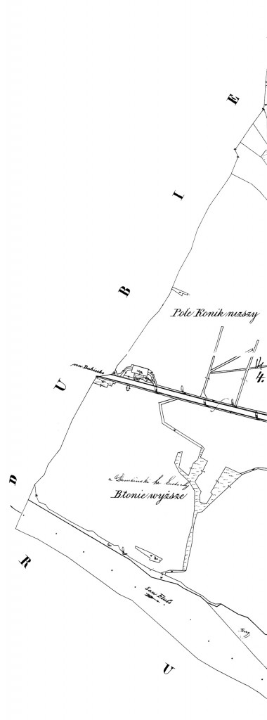
The thirteenth and fourteenth Nienadowa, Galicia Field Sketch Maps from the Ukrainian Archives show a corner of Nienadowa that includes only lands owned by Count Eustachy Dembiński who lived in house number 1.
SOURCE: “Map of the Village of Nienadowa, Galicia – 1854 (Maps 13 and 14).” Published 1854. Feldskizzen (Field Sketches), Fond 186, Opys 9, Sprava 611. State Historical Archives of Ukraine in Lviv, Lviv, Ukraine.
Click on the map above to view an enlarged image. This map fits in just to the left of maps 16 and 19.
These maps show that the lands of Count Dembiński nestled up against the shore of the San River.
Copyright © 2009 by Stephen J. Danko


