
While at my local Family History Center this past week, I discovered that the center has maps of the Austro-Hungarian Empire. I found the map for the Dubiecko-Nienadowa region where my paternal ancestors lived.
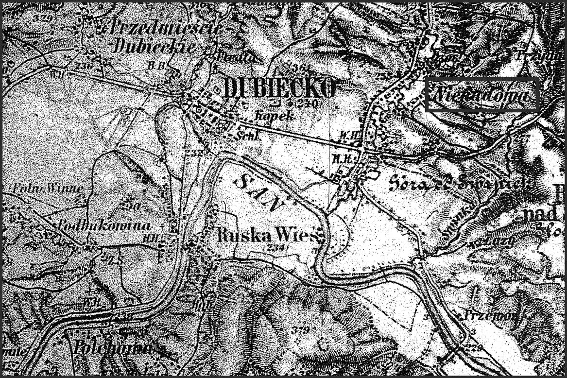
Military Map of the Dubiecko-Nienadowa Region – 1894
SOURCE: Milití¤r-Landesaufnahme und Spezialkarte der österreichisch-ungarischen Monarchie [Military Ordnance and Special Maps of the Austro-Hungarian Monarchy]. í–sterreich: Milití¤rgeographisches Institut, 1894. Family History Library microfiche 6,000,218, image 6. Family History Library, Salt lake City, Utah.
Click on the map to enlarge it .
This map shows in great detail the area of Nienadowa (highlighted by a rectangular box around the name of the village) where my grandparents (and earlier Dańko ancestors) lived. the map even shows the locations of the individual buildings in the village. I don’t know which house was my great grandparents’ home, but since this map was dated 1894, I know that they were living in one of them.
The map also shows the village of Dubiecko where the parish church was located, the location of the San River to the south, and the locations of several other small villages in the area.
This map is similar to the online maps from the 3rd Military Mapping Survey of Austria-Hungary, but is dated about a decade earlier.
Copyright © 2008 by Stephen J. Danko


