
The Polish village of Dylągowa is the location of the parish in which my paternal grandmother was probably baptized and in which my paternal grandparents were probably married. It lies close to the village of Nienadowa where my paternal grandfather lived.
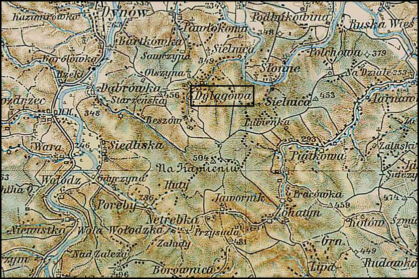
Austrian Military Map of Dylągowa – 1901Â
SOURCE: Third Military Mapping Survey of Austria-Hungary, Sheet 40-50, Przemyśl. Online http://lazarus.elte.hu/hun/digkonyv/topo/200e/40-50.jpg; downloaded 26 Apr 2008.
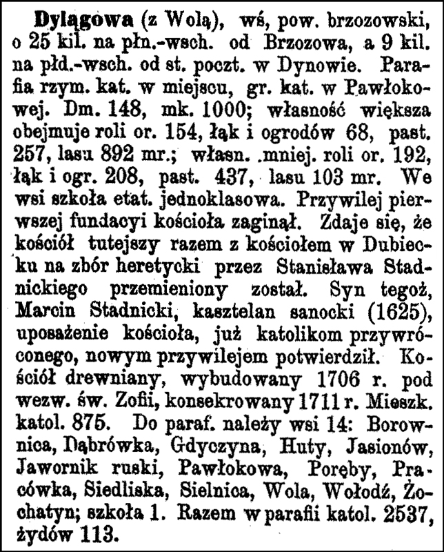
Słownik Geograficzny Entry for Dylągowa
Source: Source: Sulimierski, Filip, Bronisław Chlebowski, and Władysław Walewski, eds., Słownik Geograficzny Królestwa Polskiego i Innych Krajów Słowiańskich (Geographical Dictionary of the Kingdom of Poland and other Slavonic Countries) – Warsaw 1881, Volume II, page 244..
Click on the link for a PDF copy of the Słownik Geograficzny entry for Dylągowa. Translated from the Polish, the entry reads:
Dylągowa (with Wola), a village, Brzozów powiat [district], about 25 km to the northeast of Brzozów, and 9 km to the southeast of the post office in Dynów . A Roman Catholic parish is in the place, a Greek Catholic parish is in Pawłokowma . There are 148 houses and 1000 inhabitants;Â the larger property includes 154 mórgs [in Galicia, 1 mórg was about 1.422 acres] of soil under cultivation, 68 mórgs of pastures and gardens, 437 mórgs of pastures, and 103 mórgs of forest . A full-time, one classroom school is in the village . The first construction rights for the foundation of a church were lost . It seems that the church here together with the church in Dubiecko was changed to the heretical Protestant church by Stanisław Stadnicki . His son, Marcin Stadnicki, castellan (governor of the castle) of Sanok (1625), certified the endowment of the church, already restored to the Catholics, with a new charter . The wooden church, built in 1706 under the name of Saint Sofia, was consecrated in 1711 . There are 875 Catholic residents . 14 villages belong to the parish: Borownica, Dąbrówka, Gdyczyna, Huty, Jasionów, Jawornik ruski, Pawłokowa, Poręby, Pracówka, Siedliska, Sielnica, Wola, Wołodź, Żochatyn;Â there is one school . Altogether, there are 2537 Catholics and 113 Jews in the parish.
I have been told that the historical records of Baptisms, Marriages, and Births are no longer located at the church. The Diocesan Archives holds a copy, but researchers are not allowed to view them because the books are in poor condition.
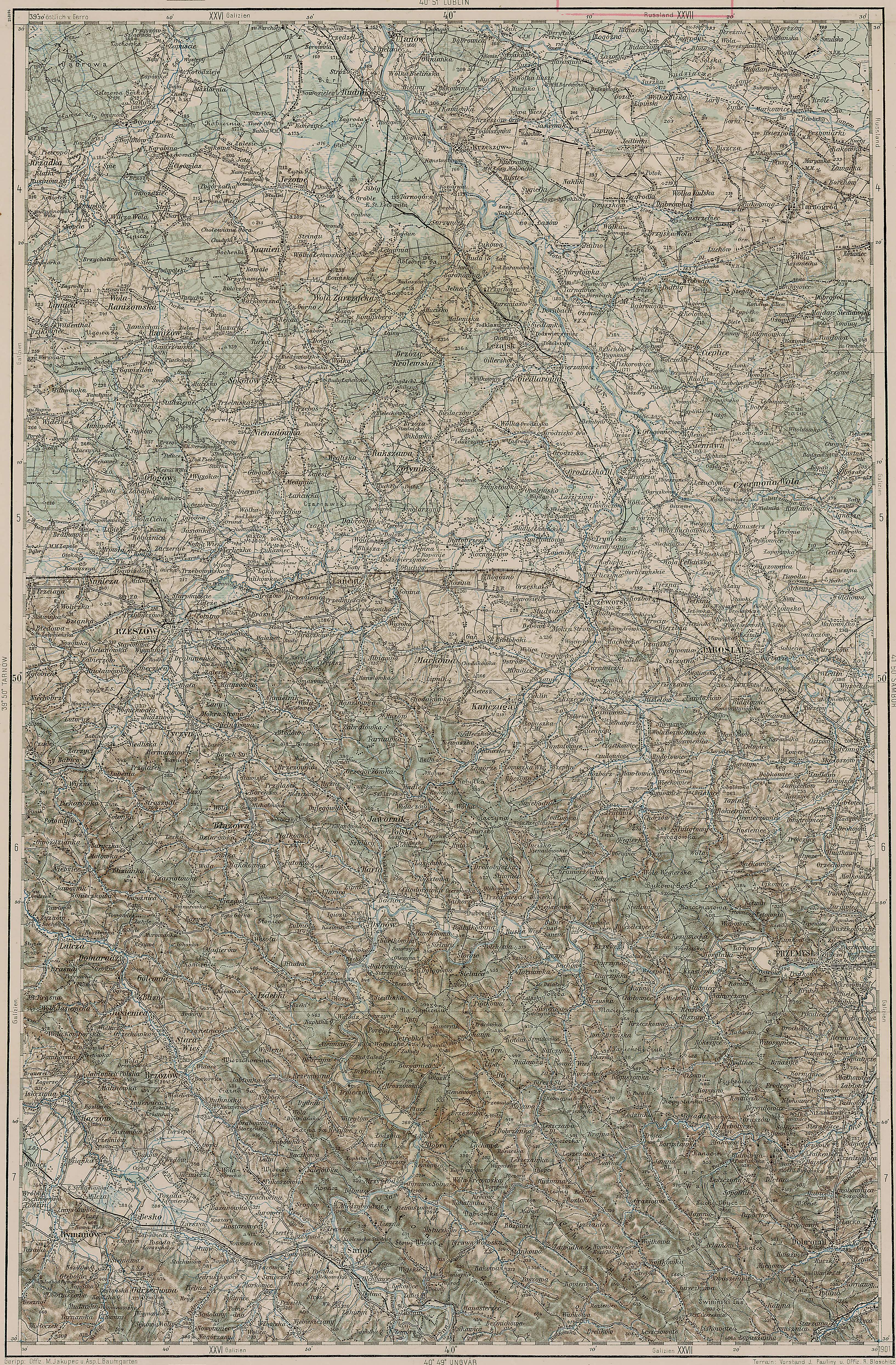
The maps of the Third Military Mapping Survey of Austria-Hungary and the entries in the Słownik Geograficzny were prepared at about the same time and make a good pair for studying places in and around the Congress Kingdom of Poland at the end of the 19th century and beginning of the 20th century, a time period when the Eastern European ancestors of present-day Americans left their homelands for the United States.
Copyright © 2008 by Stephen J. Danko


