
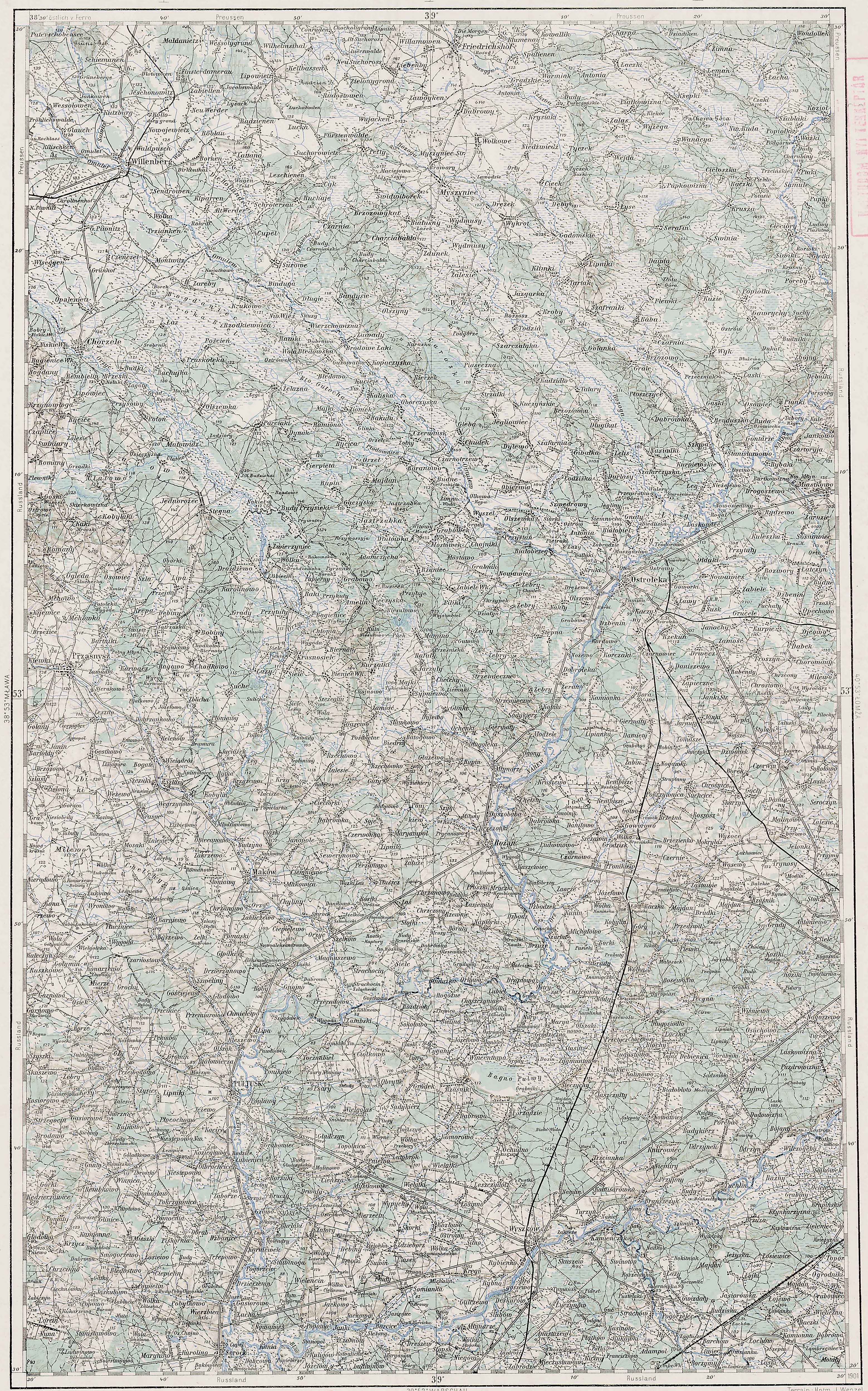
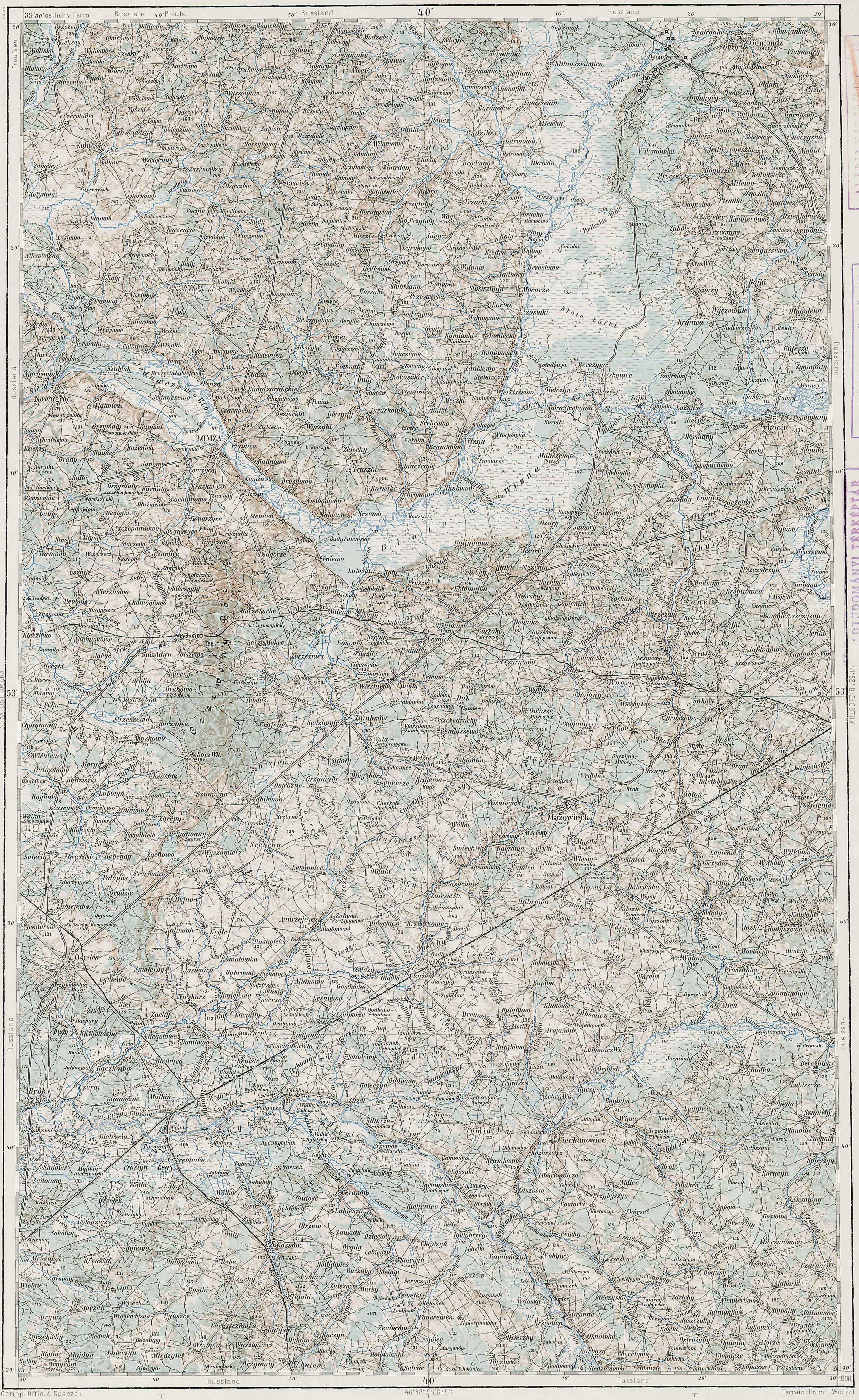
Several of my cousins descend from Józef Dymek of Dymki, Kolno, Łomża in Poland . The Słownik Geograficzny Królestwa Polskiego i Innych Krajów Słowiańskich (Geographical Dictionary of the Kingdom of Poland and other Slavonic Countries) lists three villages called Dymki, but the one that matches this location, the first in the Słownik Geograficzny entry, does not provide the location of the parish where the records would be located . The entry does, however, mention that the village was in the Czerwone Gmina . I looked up Czerwone in the Słownik Geograficzny and found a description of both the village and the Gmina of that name . The map below is a composite image of the Czerwone Gmina generated from two of the Austrian Military Maps from 1910 . The vilages that belong to the Czerwone Gmina are highlighted in black boxes . A few villages belonging to the Gmina are not on this map, but are located to the south of the area shown.

Austrian Military Map of the Czerwone Gmina – 1910
SOURCE: Third Military Mapping Survey of Austria-Hungary, Sheet 39-53, Ostroleka and Sheet 40-53, Lomża. Online http://lazarus.elte.hu/hun/digkonyv/topo/200e/39-53.jpg and http://lazarus.elte.hu/hun/digkonyv/topo/200e/40-53.jpg; downloaded 08 Feb 2011.

Słownik Geograficzny Entry for Czerwone
SOURCE: Sulimierski, Filip Chlebowski, Bronisław, and Władysław Walewski, eds., Słownik Geograficzny Królestwa Polskiego i Innych Krajów Słowiańskich (Geographical Dictionary of the Kingdom of Poland and other Slavonic Countries) – Warsaw 1880, Volume I, page 841.
Click on the link for a PDF copy of the Słownik Geograficzny Entry for Czerwone. Translated from the Polish, the entry reads:
 Czerwone, a village and governmental folwark [a large manorial farmstead] in the Kolno Powiat, Czerwone Gmina, and Kolno Parish . It lies about 3 versts [0.66 miles per verst] to the northwest of Kolno by a beaten path to the Wincenta storehouse . The Serafiec Lake and two others are here . In the year 1827, Czerwone counted 94 homes and 638 residents, currently there are 90 homes, 977 residents, and 3355 morgs [in the Russian partition 1 morg = 1.388 acres] of land. The Czerwone Gmina has a population of 5139 and an expanse of 10194 morgs; the Gmina office is in the village of Zabiele, the Gmina court for the second district is in Mały Płock, and the post office is in Kolno . It has a distillery, an alcohol treatment plant, a brewery, two brickyards, two mills, and a peat pit . There are three elementary schools . The Gmina consists of 4 villages of the nobility: Gromadzyn-Wykno, Gromadzyn-stary, Pachuczyn i Tyszki łabno; also 20 peasant villages: Chaberki, Czarnice, Czerwone, Dudy-nadrzeczne, Dymki, Gietki, Gorszczyzna, Jarubin, Kozioł, Kołymagi, Ludny, Nikrowizna, Ptaki, Pryski, Tupin, Samule, Ważki, Wincenta, Zabiele and Żelazne.
         Bronisław Chlebowski
Most of the villages in the gmina belong to the parish in Kolno . Wincenta belongs to the parish in Lachowo to the north. Gietki, Niksowizna, and Zelazne belong to the parish in Mały Płock to the south.
With this information, it appears that Dymki probably belonged to one of three parishes: Kolno, Lachowo, or Mały Płock.
Copyright © 2011 by Stephen J. Danko


